You are here: Home > Network List > TA - USArray Transportable Network (new EarthScope stations) Stations List
> Station Y27A Causey, NM, USA > Earthquake Result Viewer
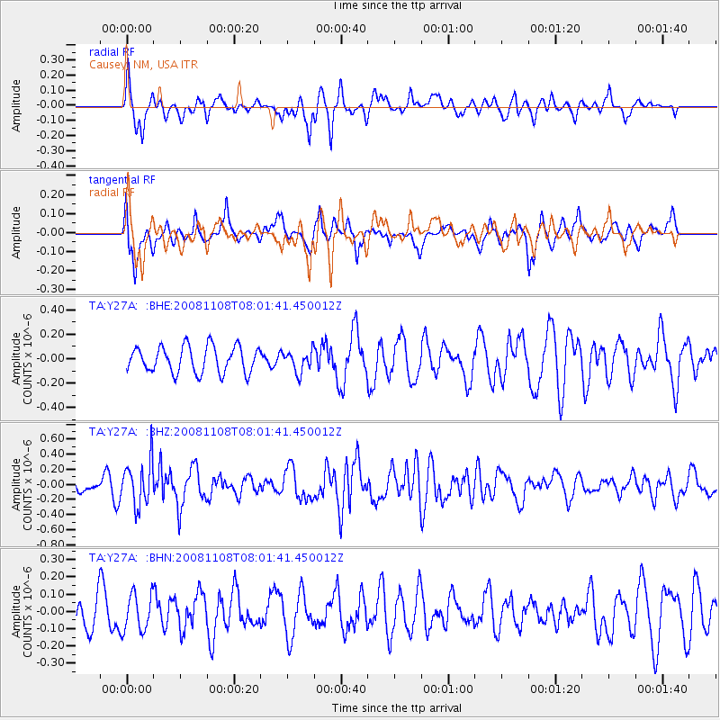
Y27A Causey, NM, USA - Earthquake Result Viewer
*The percent match for this event was below the threshold and hence no stack was calculated.
| Earthquake location: |
Tonga Islands |
| Earthquake latitude/longitude: |
-15.2/-174.2 |
| Earthquake time(UTC): |
2008/11/08 (313) 07:49:59 GMT |
| Earthquake Depth: |
121 km |
| Earthquake Magnitude: |
6.0 MW, 5.4 MB, 6.0 MW |
| Earthquake Catalog/Contributor: |
WHDF/NEIC |
|
| Network: |
TA USArray Transportable Network (new EarthScope stations) |
| Station: |
Y27A Causey, NM, USA |
| Lat/Lon: |
33.88 N/103.16 W |
| Elevation: |
1253 m |
|
| Distance: |
83.4 deg |
| Az: |
52.394 deg |
| Baz: |
246.826 deg |
| Ray Param: |
$rayparam |
*The percent match for this event was below the threshold and hence was not used in the summary stack. |
|
| Radial Match: |
68.688354 % |
| Radial Bump: |
329 |
| Transverse Match: |
57.935238 % |
| Transverse Bump: |
400 |
| SOD ConfigId: |
2658 |
| Insert Time: |
2010-03-06 20:52:14.053 +0000 |
| GWidth: |
2.5 |
| Max Bumps: |
400 |
| Tol: |
0.001 |
|
Signal To Noise
| Channel | StoN | STA | LTA |
| TA:Y27A: :BHZ:20081108T08:01:41.450012Z | 2.2890182 | 2.93246E-7 | 1.2810995E-7 |
| TA:Y27A: :BHN:20081108T08:01:41.450012Z | 1.085696 | 1.0733506E-7 | 9.886291E-8 |
| TA:Y27A: :BHE:20081108T08:01:41.450012Z | 0.81457484 | 8.7599695E-8 | 1.07540394E-7 |
| Arrivals |
| Ps | |
| PpPs | |
| PsPs/PpSs | |


