You are here: Home > Network List > IU - Global Seismograph Network (GSN - IRIS/USGS) Stations List
> Station PMG Port Moresby, New Guinea > Earthquake Result Viewer
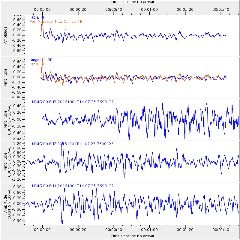
PMG Port Moresby, New Guinea - Earthquake Result Viewer
*The percent match for this event was below the threshold and hence no stack was calculated.
| Earthquake location: |
Bonin Islands, Japan Region |
| Earthquake latitude/longitude: |
27.9/142.0 |
| Earthquake time(UTC): |
2016/10/04 (278) 14:00:46 GMT |
| Earthquake Depth: |
30 km |
| Earthquake Magnitude: |
5.6 MO |
| Earthquake Catalog/Contributor: |
NEIC PDE/NEIC ALERT |
|
| Network: |
IU Global Seismograph Network (GSN - IRIS/USGS) |
| Station: |
PMG Port Moresby, New Guinea |
| Lat/Lon: |
9.40 S/147.16 E |
| Elevation: |
90 m |
|
| Distance: |
37.4 deg |
| Az: |
171.532 deg |
| Baz: |
352.409 deg |
| Ray Param: |
$rayparam |
*The percent match for this event was below the threshold and hence was not used in the summary stack. |
|
| Radial Match: |
78.45083 % |
| Radial Bump: |
400 |
| Transverse Match: |
77.60939 % |
| Transverse Bump: |
400 |
| SOD ConfigId: |
1634031 |
| Insert Time: |
2016-10-18 14:05:55.218 +0000 |
| GWidth: |
2.5 |
| Max Bumps: |
400 |
| Tol: |
0.001 |
|
Signal To Noise
| Channel | StoN | STA | LTA |
| IU:PMG:00:BHZ:20161004T14:07:25.769012Z | 2.3801568 | 2.6753682E-7 | 1.1240302E-7 |
| IU:PMG:00:BH1:20161004T14:07:25.769012Z | 2.7754464 | 2.1373967E-7 | 7.701092E-8 |
| IU:PMG:00:BH2:20161004T14:07:25.769012Z | 1.7859246 | 1.420827E-7 | 7.955694E-8 |
| Arrivals |
| Ps | |
| PpPs | |
| PsPs/PpSs | |


