You are here: Home > Network List > CI - Caltech Regional Seismic Network Stations List
> Station MPM Manuel Prospect Mine, California, USA > Earthquake Result Viewer
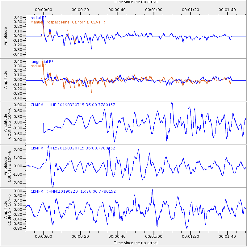
MPM Manuel Prospect Mine, California, USA - Earthquake Result Viewer
*The percent match for this event was below the threshold and hence no stack was calculated.
| Earthquake location: |
Vanuatu Islands |
| Earthquake latitude/longitude: |
-15.6/167.6 |
| Earthquake time(UTC): |
2019/03/20 (079) 15:23:59 GMT |
| Earthquake Depth: |
125 km |
| Earthquake Magnitude: |
6.2 Mww |
| Earthquake Catalog/Contributor: |
NEIC PDE/us |
|
| Network: |
CI Caltech Regional Seismic Network |
| Station: |
MPM Manuel Prospect Mine, California, USA |
| Lat/Lon: |
36.06 N/117.49 W |
| Elevation: |
185 m |
|
| Distance: |
87.3 deg |
| Az: |
51.553 deg |
| Baz: |
248.636 deg |
| Ray Param: |
$rayparam |
*The percent match for this event was below the threshold and hence was not used in the summary stack. |
|
| Radial Match: |
72.28248 % |
| Radial Bump: |
400 |
| Transverse Match: |
52.511967 % |
| Transverse Bump: |
400 |
| SOD ConfigId: |
13570011 |
| Insert Time: |
2019-05-02 18:39:22.584 +0000 |
| GWidth: |
2.5 |
| Max Bumps: |
400 |
| Tol: |
0.001 |
|
Signal To Noise
| Channel | StoN | STA | LTA |
| CI:MPM: :HHZ:20190320T15:36:00.778015Z | 7.347061 | 1.3218565E-6 | 1.7991636E-7 |
| CI:MPM: :HHN:20190320T15:36:00.778015Z | 1.0145828 | 2.5432664E-7 | 2.5067115E-7 |
| CI:MPM: :HHE:20190320T15:36:00.778015Z | 1.5670184 | 3.8022995E-7 | 2.4264548E-7 |
| Arrivals |
| Ps | |
| PpPs | |
| PsPs/PpSs | |


