You are here: Home > Network List > TA - USArray Transportable Network (new EarthScope stations) Stations List
> Station Y27A Causey, NM, USA > Earthquake Result Viewer
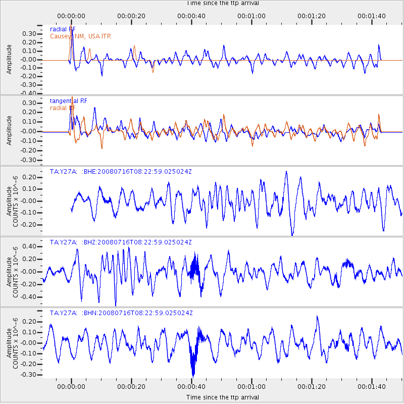
Y27A Causey, NM, USA - Earthquake Result Viewer
*The percent match for this event was below the threshold and hence no stack was calculated.
| Earthquake location: |
Samoa Islands Region |
| Earthquake latitude/longitude: |
-16.6/-173.0 |
| Earthquake time(UTC): |
2008/07/16 (198) 08:11:04 GMT |
| Earthquake Depth: |
10 km |
| Earthquake Magnitude: |
5.5 MB, 5.4 MS, 5.7 MW, 5.7 MW |
| Earthquake Catalog/Contributor: |
WHDF/NEIC |
|
| Network: |
TA USArray Transportable Network (new EarthScope stations) |
| Station: |
Y27A Causey, NM, USA |
| Lat/Lon: |
33.88 N/103.16 W |
| Elevation: |
1253 m |
|
| Distance: |
83.2 deg |
| Az: |
51.833 deg |
| Baz: |
244.984 deg |
| Ray Param: |
$rayparam |
*The percent match for this event was below the threshold and hence was not used in the summary stack. |
|
| Radial Match: |
64.59842 % |
| Radial Bump: |
372 |
| Transverse Match: |
58.167446 % |
| Transverse Bump: |
400 |
| SOD ConfigId: |
2504 |
| Insert Time: |
2010-03-06 20:52:19.971 +0000 |
| GWidth: |
2.5 |
| Max Bumps: |
400 |
| Tol: |
0.001 |
|
Signal To Noise
| Channel | StoN | STA | LTA |
| TA:Y27A: :BHZ:20080716T08:22:59.025024Z | 2.058029 | 2.0710412E-7 | 1.0063226E-7 |
| TA:Y27A: :BHN:20080716T08:22:59.025024Z | 1.212097 | 8.7203944E-8 | 7.194468E-8 |
| TA:Y27A: :BHE:20080716T08:22:59.025024Z | 1.3766756 | 8.955769E-8 | 6.505359E-8 |
| Arrivals |
| Ps | |
| PpPs | |
| PsPs/PpSs | |


