You are here: Home > Network List > CN - Canadian National Seismograph Network Stations List
> Station INK INUVIK, NT > Earthquake Result Viewer
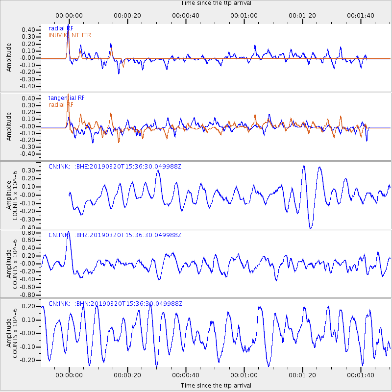
INK INUVIK, NT - Earthquake Result Viewer
*The percent match for this event was below the threshold and hence no stack was calculated.
| Earthquake location: |
Vanuatu Islands |
| Earthquake latitude/longitude: |
-15.6/167.6 |
| Earthquake time(UTC): |
2019/03/20 (079) 15:23:59 GMT |
| Earthquake Depth: |
125 km |
| Earthquake Magnitude: |
6.2 Mww |
| Earthquake Catalog/Contributor: |
NEIC PDE/us |
|
| Network: |
CN Canadian National Seismograph Network |
| Station: |
INK INUVIK, NT |
| Lat/Lon: |
68.31 N/133.53 W |
| Elevation: |
44 m |
|
| Distance: |
93.6 deg |
| Az: |
18.595 deg |
| Baz: |
235.731 deg |
| Ray Param: |
$rayparam |
*The percent match for this event was below the threshold and hence was not used in the summary stack. |
|
| Radial Match: |
65.50868 % |
| Radial Bump: |
400 |
| Transverse Match: |
54.18633 % |
| Transverse Bump: |
400 |
| SOD ConfigId: |
13570011 |
| Insert Time: |
2019-05-02 18:40:05.155 +0000 |
| GWidth: |
2.5 |
| Max Bumps: |
400 |
| Tol: |
0.001 |
|
Signal To Noise
| Channel | StoN | STA | LTA |
| CN:INK: :BHZ:20190320T15:36:30.049988Z | 2.9792936 | 4.2679798E-7 | 1.4325475E-7 |
| CN:INK: :BHN:20190320T15:36:30.049988Z | 1.1486611 | 1.1965746E-7 | 1.0417125E-7 |
| CN:INK: :BHE:20190320T15:36:30.049988Z | 1.7912947 | 1.7771627E-7 | 9.921108E-8 |
| Arrivals |
| Ps | |
| PpPs | |
| PsPs/PpSs | |


