You are here: Home > Network List > TA - USArray Transportable Network (new EarthScope stations) Stations List
> Station G21K Allakaket, AK, USA > Earthquake Result Viewer
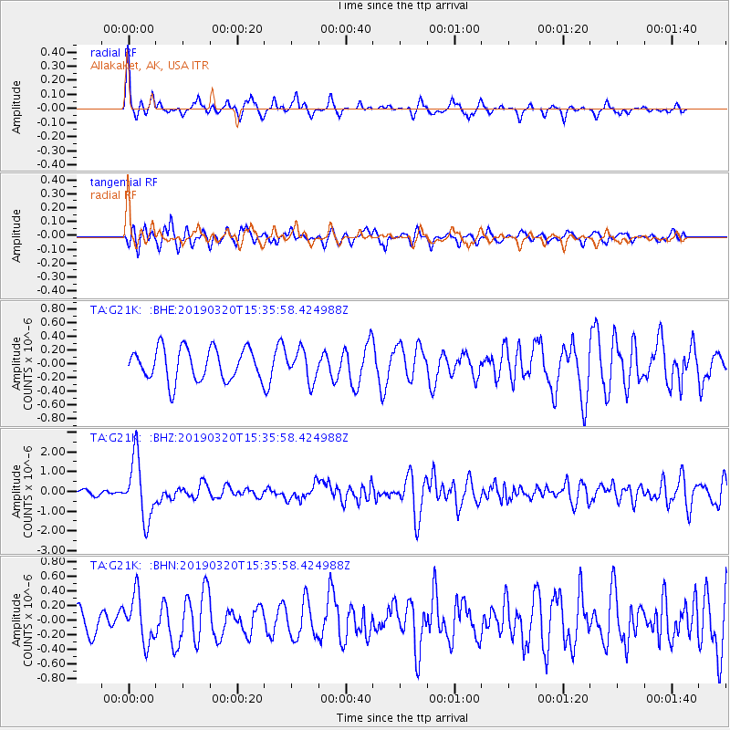
G21K Allakaket, AK, USA - Earthquake Result Viewer
*The percent match for this event was below the threshold and hence no stack was calculated.
| Earthquake location: |
Vanuatu Islands |
| Earthquake latitude/longitude: |
-15.6/167.6 |
| Earthquake time(UTC): |
2019/03/20 (079) 15:23:59 GMT |
| Earthquake Depth: |
125 km |
| Earthquake Magnitude: |
6.2 Mww |
| Earthquake Catalog/Contributor: |
NEIC PDE/us |
|
| Network: |
TA USArray Transportable Network (new EarthScope stations) |
| Station: |
G21K Allakaket, AK, USA |
| Lat/Lon: |
66.52 N/153.51 W |
| Elevation: |
446 m |
|
| Distance: |
86.8 deg |
| Az: |
14.594 deg |
| Baz: |
217.287 deg |
| Ray Param: |
$rayparam |
*The percent match for this event was below the threshold and hence was not used in the summary stack. |
|
| Radial Match: |
73.90342 % |
| Radial Bump: |
313 |
| Transverse Match: |
64.314545 % |
| Transverse Bump: |
400 |
| SOD ConfigId: |
13570011 |
| Insert Time: |
2019-05-02 18:43:33.570 +0000 |
| GWidth: |
2.5 |
| Max Bumps: |
400 |
| Tol: |
0.001 |
|
Signal To Noise
| Channel | StoN | STA | LTA |
| TA:G21K: :BHZ:20190320T15:35:58.424988Z | 12.3618765 | 1.5488177E-6 | 1.2528986E-7 |
| TA:G21K: :BHN:20190320T15:35:58.424988Z | 1.985067 | 3.2532787E-7 | 1.6388759E-7 |
| TA:G21K: :BHE:20190320T15:35:58.424988Z | 0.919936 | 2.1768173E-7 | 2.3662703E-7 |
| Arrivals |
| Ps | |
| PpPs | |
| PsPs/PpSs | |


