You are here: Home > Network List > TA - USArray Transportable Network (new EarthScope stations) Stations List
> Station R33M Jennings River, BC, CAN > Earthquake Result Viewer
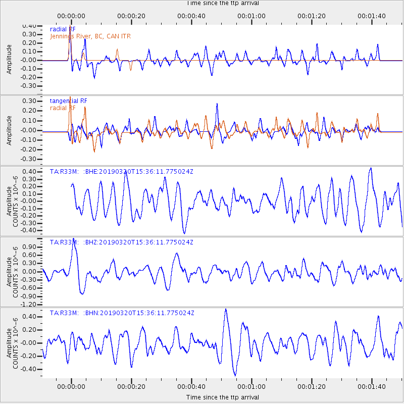
R33M Jennings River, BC, CAN - Earthquake Result Viewer
*The percent match for this event was below the threshold and hence no stack was calculated.
| Earthquake location: |
Vanuatu Islands |
| Earthquake latitude/longitude: |
-15.6/167.6 |
| Earthquake time(UTC): |
2019/03/20 (079) 15:23:59 GMT |
| Earthquake Depth: |
125 km |
| Earthquake Magnitude: |
6.2 Mww |
| Earthquake Catalog/Contributor: |
NEIC PDE/us |
|
| Network: |
TA USArray Transportable Network (new EarthScope stations) |
| Station: |
R33M Jennings River, BC, CAN |
| Lat/Lon: |
59.39 N/130.97 W |
| Elevation: |
1437 m |
|
| Distance: |
89.7 deg |
| Az: |
26.701 deg |
| Baz: |
237.798 deg |
| Ray Param: |
$rayparam |
*The percent match for this event was below the threshold and hence was not used in the summary stack. |
|
| Radial Match: |
65.16532 % |
| Radial Bump: |
400 |
| Transverse Match: |
49.25902 % |
| Transverse Bump: |
400 |
| SOD ConfigId: |
13570011 |
| Insert Time: |
2019-05-02 18:44:45.165 +0000 |
| GWidth: |
2.5 |
| Max Bumps: |
400 |
| Tol: |
0.001 |
|
Signal To Noise
| Channel | StoN | STA | LTA |
| TA:R33M: :BHZ:20190320T15:36:11.775024Z | 4.184861 | 6.9410095E-7 | 1.6585997E-7 |
| TA:R33M: :BHN:20190320T15:36:11.775024Z | 0.73798674 | 1.1109355E-7 | 1.5053597E-7 |
| TA:R33M: :BHE:20190320T15:36:11.775024Z | 1.0309147 | 1.9180908E-7 | 1.8605718E-7 |
| Arrivals |
| Ps | |
| PpPs | |
| PsPs/PpSs | |


