You are here: Home > Network List > UW - Pacific Northwest Regional Seismic Network Stations List
> Station FISH Seaside, OR, USA > Earthquake Result Viewer
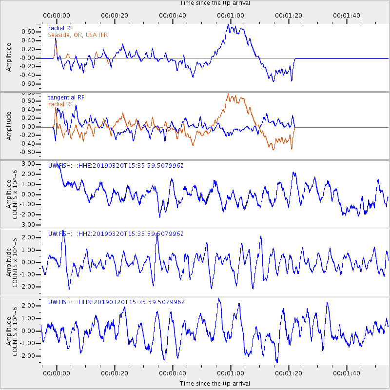
FISH Seaside, OR, USA - Earthquake Result Viewer
*The percent match for this event was below the threshold and hence no stack was calculated.
| Earthquake location: |
Vanuatu Islands |
| Earthquake latitude/longitude: |
-15.6/167.6 |
| Earthquake time(UTC): |
2019/03/20 (079) 15:23:59 GMT |
| Earthquake Depth: |
125 km |
| Earthquake Magnitude: |
6.2 Mww |
| Earthquake Catalog/Contributor: |
NEIC PDE/us |
|
| Network: |
UW Pacific Northwest Regional Seismic Network |
| Station: |
FISH Seaside, OR, USA |
| Lat/Lon: |
45.93 N/123.56 W |
| Elevation: |
325 m |
|
| Distance: |
87.1 deg |
| Az: |
40.67 deg |
| Baz: |
244.119 deg |
| Ray Param: |
$rayparam |
*The percent match for this event was below the threshold and hence was not used in the summary stack. |
|
| Radial Match: |
56.56665 % |
| Radial Bump: |
400 |
| Transverse Match: |
62.578087 % |
| Transverse Bump: |
400 |
| SOD ConfigId: |
13570011 |
| Insert Time: |
2019-05-02 18:45:44.951 +0000 |
| GWidth: |
2.5 |
| Max Bumps: |
400 |
| Tol: |
0.001 |
|
Signal To Noise
| Channel | StoN | STA | LTA |
| UW:FISH: :HHZ:20190320T15:35:59.507996Z | 3.0649445 | 1.3048018E-6 | 4.257179E-7 |
| UW:FISH: :HHN:20190320T15:35:59.507996Z | 2.0472407 | 8.1932103E-7 | 4.0020748E-7 |
| UW:FISH: :HHE:20190320T15:35:59.507996Z | 0.68025315 | 5.6675526E-7 | 8.331535E-7 |
| Arrivals |
| Ps | |
| PpPs | |
| PsPs/PpSs | |


