
DGR Domenigoni Valley Reservior, California, USA - Earthquake Result Viewer
| ||||||||||||||||||
| ||||||||||||||||||
| ||||||||||||||||||
|
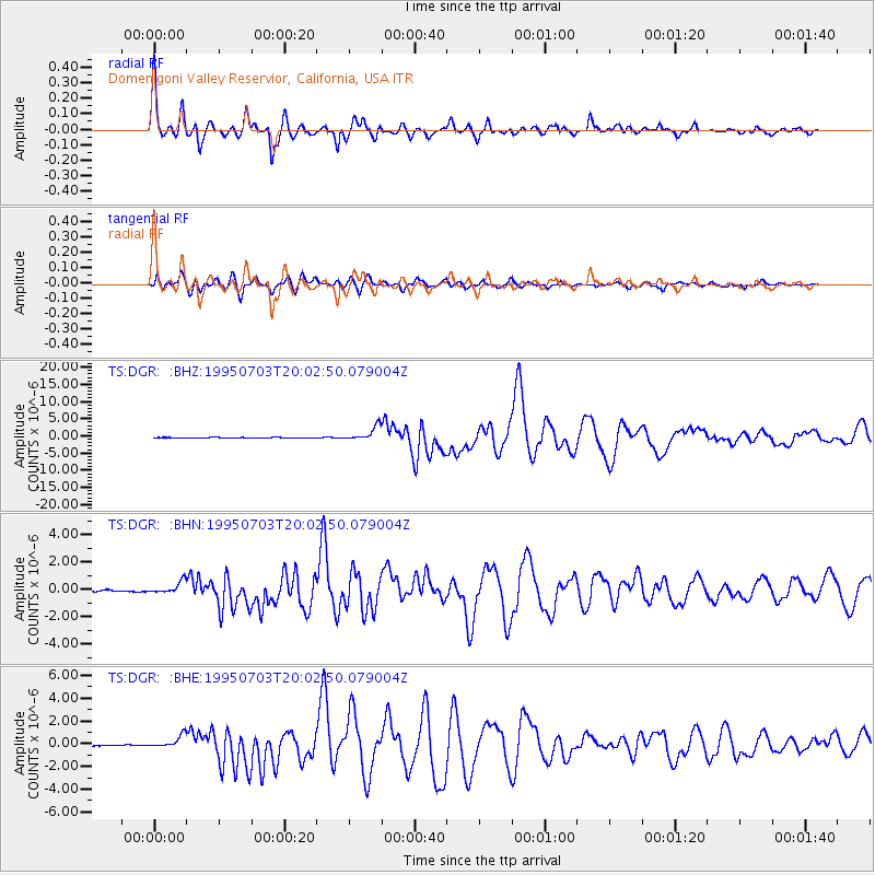
Signal To Noise
| Channel | StoN | STA | LTA |
| TS:DGR: :BHN:19950703T20:02:50.079004Z | 5.7108164 | 4.3250736E-7 | 7.5734775E-8 |
| TS:DGR: :BHE:19950703T20:02:50.079004Z | 12.133963 | 5.3962236E-7 | 4.4472067E-8 |
| TS:DGR: :BHZ:19950703T20:02:50.079004Z | 25.350866 | 2.0333139E-6 | 8.0206874E-8 |
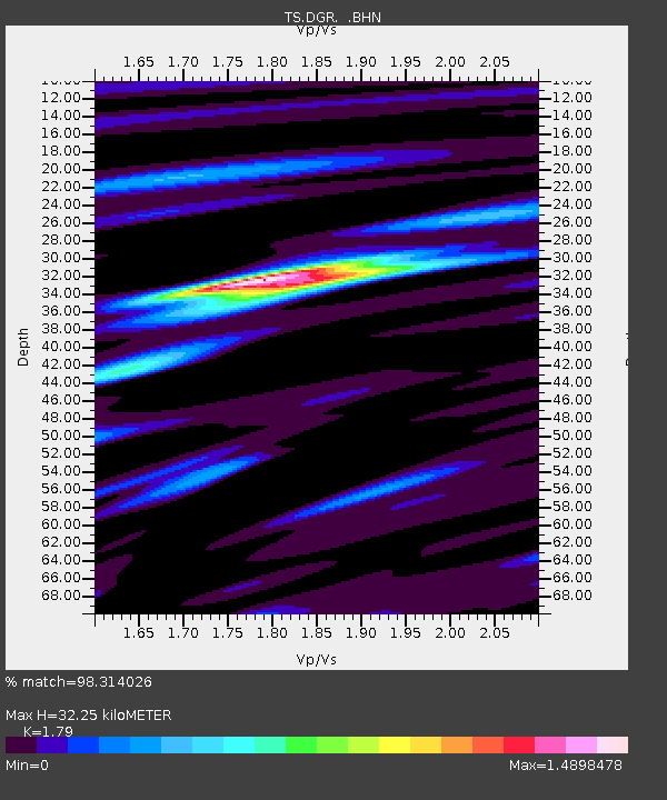
| Arrivals | |
| Ps | 4.2 SECOND |
| PpPs | 14 SECOND |
| PsPs/PpSs | 18 SECOND |

