You are here: Home > Network List > TA - USArray Transportable Network (new EarthScope stations) Stations List
> Station D23K Nanushuk River, AK USA > Earthquake Result Viewer
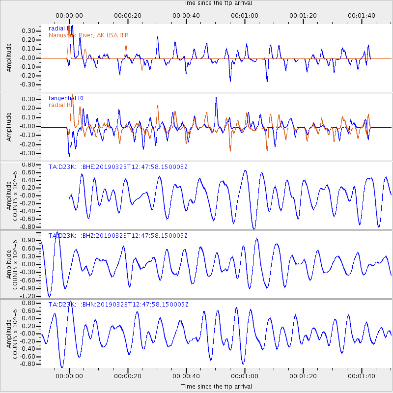
D23K Nanushuk River, AK USA - Earthquake Result Viewer
*The percent match for this event was below the threshold and hence no stack was calculated.
| Earthquake location: |
Central Mid-Atlantic Ridge |
| Earthquake latitude/longitude: |
7.5/-37.1 |
| Earthquake time(UTC): |
2019/03/23 (082) 12:35:24 GMT |
| Earthquake Depth: |
10 km |
| Earthquake Magnitude: |
5.3 Mww |
| Earthquake Catalog/Contributor: |
NEIC PDE/us |
|
| Network: |
TA USArray Transportable Network (new EarthScope stations) |
| Station: |
D23K Nanushuk River, AK USA |
| Lat/Lon: |
68.97 N/150.68 W |
| Elevation: |
406 m |
|
| Distance: |
91.2 deg |
| Az: |
340.668 deg |
| Baz: |
65.386 deg |
| Ray Param: |
$rayparam |
*The percent match for this event was below the threshold and hence was not used in the summary stack. |
|
| Radial Match: |
59.19995 % |
| Radial Bump: |
394 |
| Transverse Match: |
70.162384 % |
| Transverse Bump: |
400 |
| SOD ConfigId: |
13570011 |
| Insert Time: |
2019-05-02 19:02:03.503 +0000 |
| GWidth: |
2.5 |
| Max Bumps: |
400 |
| Tol: |
0.001 |
|
Signal To Noise
| Channel | StoN | STA | LTA |
| TA:D23K: :BHZ:20190323T12:47:58.150005Z | 0.8545952 | 4.1385096E-7 | 4.842655E-7 |
| TA:D23K: :BHN:20190323T12:47:58.150005Z | 1.9457408 | 5.211233E-7 | 2.6782772E-7 |
| TA:D23K: :BHE:20190323T12:47:58.150005Z | 1.4552219 | 3.7604664E-7 | 2.584119E-7 |
| Arrivals |
| Ps | |
| PpPs | |
| PsPs/PpSs | |


