You are here: Home > Network List > II - Global Seismograph Network (GSN - IRIS/IDA) Stations List
> Station WRAB Tennant Creek, NT, Australia > Earthquake Result Viewer
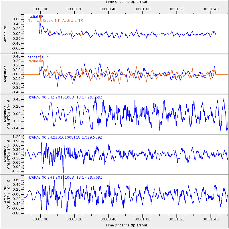
WRAB Tennant Creek, NT, Australia - Earthquake Result Viewer
*The percent match for this event was below the threshold and hence no stack was calculated.
| Earthquake location: |
Mariana Islands Region |
| Earthquake latitude/longitude: |
20.0/146.8 |
| Earthquake time(UTC): |
2016/10/08 (282) 18:10:13 GMT |
| Earthquake Depth: |
10 km |
| Earthquake Magnitude: |
5.6 MB, 5.6 MB |
| Earthquake Catalog/Contributor: |
NEIC PDE/NEIC ALERT |
|
| Network: |
II Global Seismograph Network (GSN - IRIS/IDA) |
| Station: |
WRAB Tennant Creek, NT, Australia |
| Lat/Lon: |
19.93 S/134.36 E |
| Elevation: |
366 m |
|
| Distance: |
41.5 deg |
| Az: |
197.753 deg |
| Baz: |
17.743 deg |
| Ray Param: |
$rayparam |
*The percent match for this event was below the threshold and hence was not used in the summary stack. |
|
| Radial Match: |
61.811977 % |
| Radial Bump: |
400 |
| Transverse Match: |
62.03319 % |
| Transverse Bump: |
400 |
| SOD ConfigId: |
1634031 |
| Insert Time: |
2016-10-22 18:13:02.906 +0000 |
| GWidth: |
2.5 |
| Max Bumps: |
400 |
| Tol: |
0.001 |
|
Signal To Noise
| Channel | StoN | STA | LTA |
| II:WRAB:00:BHZ:20161008T18:17:29.569Z | 2.3216896 | 4.3648288E-7 | 1.8800225E-7 |
| II:WRAB:00:BH1:20161008T18:17:29.569Z | 2.1692421 | 2.8390866E-7 | 1.308792E-7 |
| II:WRAB:00:BH2:20161008T18:17:29.569Z | 1.6689422 | 2.9458727E-7 | 1.7651136E-7 |
| Arrivals |
| Ps | |
| PpPs | |
| PsPs/PpSs | |


