You are here: Home > Network List > CN - Canadian National Seismograph Network Stations List
> Station INK INUVIK, NT > Earthquake Result Viewer
INK INUVIK, NT - Earthquake Result Viewer
*The percent match for this event was below the threshold and hence no stack was calculated.
| Earthquake location: |
Northern Molucca Sea |
| Earthquake latitude/longitude: |
1.7/126.4 |
| Earthquake time(UTC): |
2019/03/24 (083) 04:37:34 GMT |
| Earthquake Depth: |
37 km |
| Earthquake Magnitude: |
6.1 Mww |
| Earthquake Catalog/Contributor: |
NEIC PDE/us |
|
| Network: |
CN Canadian National Seismograph Network |
| Station: |
INK INUVIK, NT |
| Lat/Lon: |
68.31 N/133.53 W |
| Elevation: |
44 m |
|
| Distance: |
92.1 deg |
| Az: |
21.49 deg |
| Baz: |
279.967 deg |
| Ray Param: |
$rayparam |
*The percent match for this event was below the threshold and hence was not used in the summary stack. |
|
| Radial Match: |
55.94506 % |
| Radial Bump: |
400 |
| Transverse Match: |
50.127377 % |
| Transverse Bump: |
400 |
| SOD ConfigId: |
13570011 |
| Insert Time: |
2019-05-02 19:21:28.026 +0000 |
| GWidth: |
2.5 |
| Max Bumps: |
400 |
| Tol: |
0.001 |
|
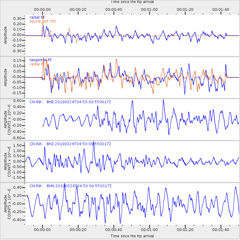
Signal To Noise
| Channel | StoN | STA | LTA |
| CN:INK: :BHZ:20190324T04:50:09.550017Z | 2.4758584 | 4.885615E-7 | 1.9733015E-7 |
| CN:INK: :BHN:20190324T04:50:09.550017Z | 0.68305206 | 1.6087748E-7 | 2.3552741E-7 |
| CN:INK: :BHE:20190324T04:50:09.550017Z | 1.4552362 | 1.7627995E-7 | 1.2113493E-7 |
| Arrivals |
| Ps | |
| PpPs | |
| PsPs/PpSs | |


