You are here: Home > Network List > TA - USArray Transportable Network (new EarthScope stations) Stations List
> Station F21K Alatna River, AK, USA > Earthquake Result Viewer
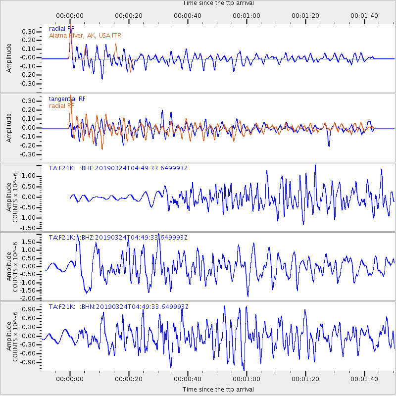
F21K Alatna River, AK, USA - Earthquake Result Viewer
*The percent match for this event was below the threshold and hence no stack was calculated.
| Earthquake location: |
Northern Molucca Sea |
| Earthquake latitude/longitude: |
1.7/126.4 |
| Earthquake time(UTC): |
2019/03/24 (083) 04:37:34 GMT |
| Earthquake Depth: |
37 km |
| Earthquake Magnitude: |
6.1 Mww |
| Earthquake Catalog/Contributor: |
NEIC PDE/us |
|
| Network: |
TA USArray Transportable Network (new EarthScope stations) |
| Station: |
F21K Alatna River, AK, USA |
| Lat/Lon: |
67.22 N/153.48 W |
| Elevation: |
597 m |
|
| Distance: |
84.6 deg |
| Az: |
22.661 deg |
| Baz: |
261.517 deg |
| Ray Param: |
$rayparam |
*The percent match for this event was below the threshold and hence was not used in the summary stack. |
|
| Radial Match: |
79.41328 % |
| Radial Bump: |
400 |
| Transverse Match: |
61.819736 % |
| Transverse Bump: |
400 |
| SOD ConfigId: |
13570011 |
| Insert Time: |
2019-05-02 19:23:34.300 +0000 |
| GWidth: |
2.5 |
| Max Bumps: |
400 |
| Tol: |
0.001 |
|
Signal To Noise
| Channel | StoN | STA | LTA |
| TA:F21K: :BHZ:20190324T04:49:33.649993Z | 6.7491574 | 8.6953605E-7 | 1.2883625E-7 |
| TA:F21K: :BHN:20190324T04:49:33.649993Z | 1.4478674 | 1.5323447E-7 | 1.05834594E-7 |
| TA:F21K: :BHE:20190324T04:49:33.649993Z | 3.7178943 | 3.2161344E-7 | 8.6504194E-8 |
| Arrivals |
| Ps | |
| PpPs | |
| PsPs/PpSs | |


