You are here: Home > Network List > TA - USArray Transportable Network (new EarthScope stations) Stations List
> Station G31M Satah River, YT, CAN > Earthquake Result Viewer
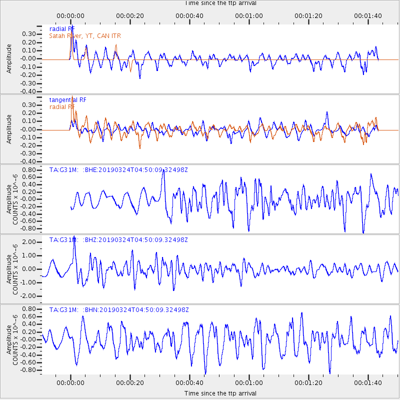
G31M Satah River, YT, CAN - Earthquake Result Viewer
*The percent match for this event was below the threshold and hence no stack was calculated.
| Earthquake location: |
Northern Molucca Sea |
| Earthquake latitude/longitude: |
1.7/126.4 |
| Earthquake time(UTC): |
2019/03/24 (083) 04:37:34 GMT |
| Earthquake Depth: |
37 km |
| Earthquake Magnitude: |
6.1 Mww |
| Earthquake Catalog/Contributor: |
NEIC PDE/us |
|
| Network: |
TA USArray Transportable Network (new EarthScope stations) |
| Station: |
G31M Satah River, YT, CAN |
| Lat/Lon: |
66.92 N/134.27 W |
| Elevation: |
61 m |
|
| Distance: |
92.1 deg |
| Az: |
22.909 deg |
| Baz: |
279.226 deg |
| Ray Param: |
$rayparam |
*The percent match for this event was below the threshold and hence was not used in the summary stack. |
|
| Radial Match: |
71.76224 % |
| Radial Bump: |
400 |
| Transverse Match: |
38.591545 % |
| Transverse Bump: |
364 |
| SOD ConfigId: |
13570011 |
| Insert Time: |
2019-05-02 19:23:47.633 +0000 |
| GWidth: |
2.5 |
| Max Bumps: |
400 |
| Tol: |
0.001 |
|
Signal To Noise
| Channel | StoN | STA | LTA |
| TA:G31M: :BHZ:20190324T04:50:09.32498Z | 3.29132 | 9.51166E-7 | 2.8899225E-7 |
| TA:G31M: :BHN:20190324T04:50:09.32498Z | 1.2957413 | 3.7093199E-7 | 2.862701E-7 |
| TA:G31M: :BHE:20190324T04:50:09.32498Z | 2.4134328 | 4.207492E-7 | 1.743364E-7 |
| Arrivals |
| Ps | |
| PpPs | |
| PsPs/PpSs | |


