You are here: Home > Network List > GT - Global Telemetered Seismograph Network (USAF/USGS) Stations List
> Station LPAZ La Paz , Bolivia > Earthquake Result Viewer
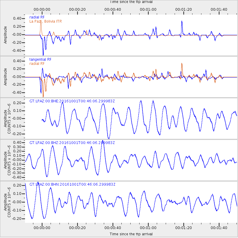
LPAZ La Paz , Bolivia - Earthquake Result Viewer
*The percent match for this event was below the threshold and hence no stack was calculated.
| Earthquake location: |
Tonga Islands Region |
| Earthquake latitude/longitude: |
-23.7/-174.9 |
| Earthquake time(UTC): |
2016/10/01 (275) 00:33:04 GMT |
| Earthquake Depth: |
35 km |
| Earthquake Magnitude: |
5.6 MWC, 5.6 MWC |
| Earthquake Catalog/Contributor: |
NEIC PDE/NEIC COMCAT |
|
| Network: |
GT Global Telemetered Seismograph Network (USAF/USGS) |
| Station: |
LPAZ La Paz , Bolivia |
| Lat/Lon: |
16.17 S/68.08 W |
| Elevation: |
4817 m |
|
| Distance: |
98.3 deg |
| Az: |
111.637 deg |
| Baz: |
242.462 deg |
| Ray Param: |
$rayparam |
*The percent match for this event was below the threshold and hence was not used in the summary stack. |
|
| Radial Match: |
71.8995 % |
| Radial Bump: |
400 |
| Transverse Match: |
64.24729 % |
| Transverse Bump: |
400 |
| SOD ConfigId: |
1634031 |
| Insert Time: |
2016-10-22 23:31:07.564 +0000 |
| GWidth: |
2.5 |
| Max Bumps: |
400 |
| Tol: |
0.001 |
|
Signal To Noise
| Channel | StoN | STA | LTA |
| GT:LPAZ:00:BHZ:20161001T00:46:06.299983Z | 2.9745724 | 2.2508387E-7 | 7.566932E-8 |
| GT:LPAZ:00:BHN:20161001T00:46:06.299983Z | 0.9739847 | 1.2922683E-7 | 1.3267851E-7 |
| GT:LPAZ:00:BHE:20161001T00:46:06.299983Z | 1.4592916 | 1.3775322E-7 | 9.439733E-8 |
| Arrivals |
| Ps | |
| PpPs | |
| PsPs/PpSs | |


