You are here: Home > Network List > IW - Intermountain West Stations List
> Station MOOW Moose Ponds, Wyoming, USA > Earthquake Result Viewer
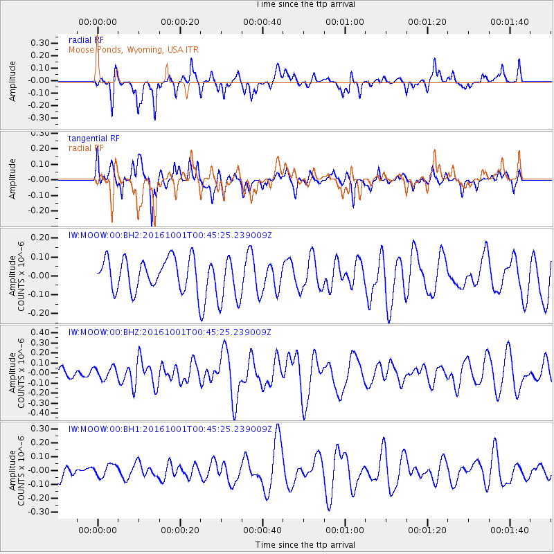
MOOW Moose Ponds, Wyoming, USA - Earthquake Result Viewer
*The percent match for this event was below the threshold and hence no stack was calculated.
| Earthquake location: |
Tonga Islands Region |
| Earthquake latitude/longitude: |
-23.7/-174.9 |
| Earthquake time(UTC): |
2016/10/01 (275) 00:33:04 GMT |
| Earthquake Depth: |
35 km |
| Earthquake Magnitude: |
5.6 MWC, 5.6 MWC |
| Earthquake Catalog/Contributor: |
NEIC PDE/NEIC COMCAT |
|
| Network: |
IW Intermountain West |
| Station: |
MOOW Moose Ponds, Wyoming, USA |
| Lat/Lon: |
43.75 N/110.74 W |
| Elevation: |
2128 m |
|
| Distance: |
89.2 deg |
| Az: |
40.712 deg |
| Baz: |
235.59 deg |
| Ray Param: |
$rayparam |
*The percent match for this event was below the threshold and hence was not used in the summary stack. |
|
| Radial Match: |
59.101658 % |
| Radial Bump: |
320 |
| Transverse Match: |
54.76275 % |
| Transverse Bump: |
400 |
| SOD ConfigId: |
1634031 |
| Insert Time: |
2016-10-22 23:32:52.722 +0000 |
| GWidth: |
2.5 |
| Max Bumps: |
400 |
| Tol: |
0.001 |
|
Signal To Noise
| Channel | StoN | STA | LTA |
| IW:MOOW:00:BHZ:20161001T00:45:25.239009Z | 0.80390567 | 5.9453505E-8 | 7.395582E-8 |
| IW:MOOW:00:BH1:20161001T00:45:25.239009Z | 0.8605487 | 4.480148E-8 | 5.206153E-8 |
| IW:MOOW:00:BH2:20161001T00:45:25.239009Z | 1.5648249 | 1.2926611E-7 | 8.260739E-8 |
| Arrivals |
| Ps | |
| PpPs | |
| PsPs/PpSs | |


