You are here: Home > Network List > TA - USArray Transportable Network (new EarthScope stations) Stations List
> Station U23A El Rito, NM, USA > Earthquake Result Viewer
U23A El Rito, NM, USA - Earthquake Result Viewer

| Earthquake location: |
Panama |
| Earthquake latitude/longitude: |
9.6/-79.0 |
| Earthquake time(UTC): |
2009/07/04 (185) 06:49:35 GMT |
| Earthquake Depth: |
38 km |
| Earthquake Magnitude: |
6.0 MB, 5.5 MS, 6.0 MW, 6.0 MW |
| Earthquake Catalog/Contributor: |
WHDF/NEIC |
|
| Network: |
TA USArray Transportable Network (new EarthScope stations) |
| Station: |
U23A El Rito, NM, USA |
| Lat/Lon: |
36.33 N/106.19 W |
| Elevation: |
2093 m |
|
| Distance: |
36.3 deg |
| Az: |
321.404 deg |
| Baz: |
130.371 deg |
| Ray Param: |
0.076669104 |
| Estimated Moho Depth: |
39.25 km |
| Estimated Crust Vp/Vs: |
1.85 |
| Assumed Crust Vp: |
6.159 km/s |
| Estimated Crust Vs: |
3.338 km/s |
| Estimated Crust Poisson's Ratio: |
0.29 |
|
| Radial Match: |
89.534225 % |
| Radial Bump: |
368 |
| Transverse Match: |
84.74247 % |
| Transverse Bump: |
400 |
| SOD ConfigId: |
2648 |
| Insert Time: |
2010-03-06 20:59:09.518 +0000 |
| GWidth: |
2.5 |
| Max Bumps: |
400 |
| Tol: |
0.001 |
|
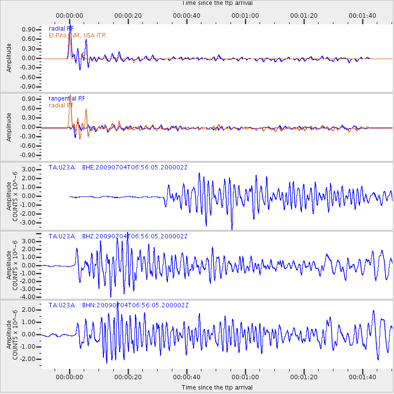
Signal To Noise
| Channel | StoN | STA | LTA |
| TA:U23A: :BHZ:20090704T06:56:05.200002Z | 21.761797 | 9.1724024E-7 | 4.2149104E-8 |
| TA:U23A: :BHN:20090704T06:56:05.200002Z | 9.748736 | 4.7247286E-7 | 4.8465036E-8 |
| TA:U23A: :BHE:20090704T06:56:05.200002Z | 10.615693 | 5.223901E-7 | 4.9209227E-8 |
| Arrivals |
| Ps | 5.7 SECOND |
| PpPs | 17 SECOND |
| PsPs/PpSs | 23 SECOND |


