You are here: Home > Network List > TA - USArray Transportable Network (new EarthScope stations) Stations List
> Station U23A El Rito, NM, USA > Earthquake Result Viewer
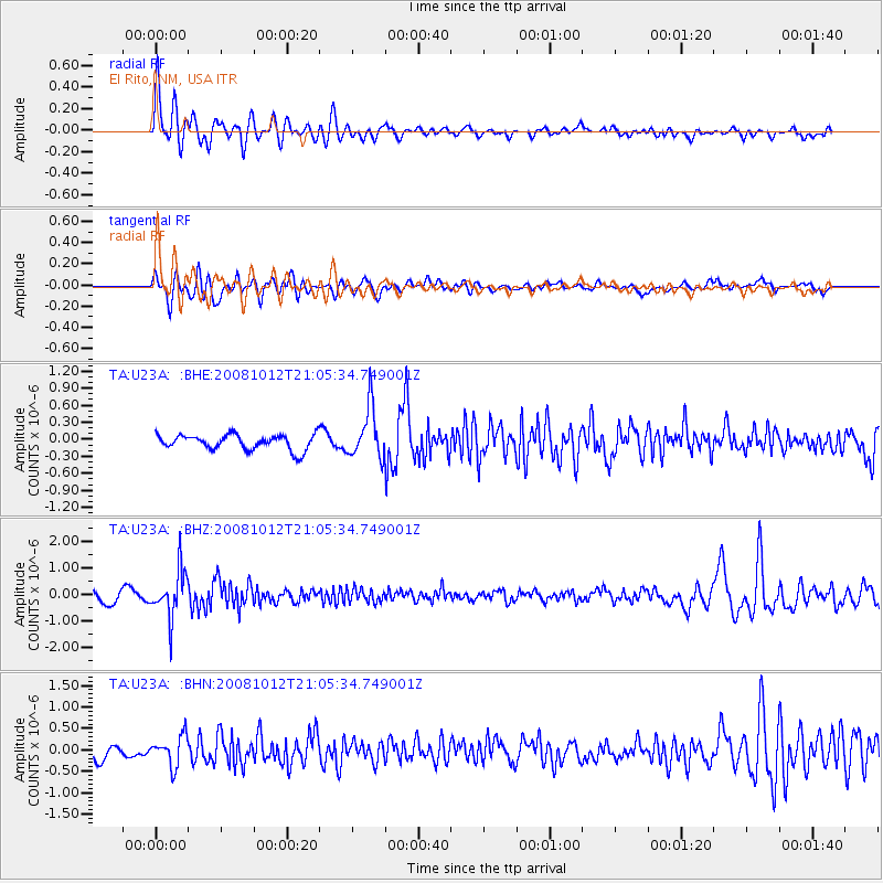
U23A El Rito, NM, USA - Earthquake Result Viewer
*The percent match for this event was below the threshold and hence no stack was calculated.
| Earthquake location: |
Southern Bolivia |
| Earthquake latitude/longitude: |
-20.1/-65.0 |
| Earthquake time(UTC): |
2008/10/12 (286) 20:55:41 GMT |
| Earthquake Depth: |
353 km |
| Earthquake Magnitude: |
6.0 MB, 6.2 MW, 6.2 MW |
| Earthquake Catalog/Contributor: |
WHDF/NEIC |
|
| Network: |
TA USArray Transportable Network (new EarthScope stations) |
| Station: |
U23A El Rito, NM, USA |
| Lat/Lon: |
36.33 N/106.19 W |
| Elevation: |
2093 m |
|
| Distance: |
68.3 deg |
| Az: |
325.072 deg |
| Baz: |
138.221 deg |
| Ray Param: |
$rayparam |
*The percent match for this event was below the threshold and hence was not used in the summary stack. |
|
| Radial Match: |
77.470764 % |
| Radial Bump: |
400 |
| Transverse Match: |
66.57768 % |
| Transverse Bump: |
400 |
| SOD ConfigId: |
2556 |
| Insert Time: |
2010-03-06 20:59:45.294 +0000 |
| GWidth: |
2.5 |
| Max Bumps: |
400 |
| Tol: |
0.001 |
|
Signal To Noise
| Channel | StoN | STA | LTA |
| TA:U23A: :BHZ:20081012T21:05:34.749001Z | 4.144701 | 8.828584E-7 | 2.1300895E-7 |
| TA:U23A: :BHN:20081012T21:05:34.749001Z | 2.4767587 | 3.4660792E-7 | 1.3994416E-7 |
| TA:U23A: :BHE:20081012T21:05:34.749001Z | 3.304073 | 4.433644E-7 | 1.3418723E-7 |
| Arrivals |
| Ps | |
| PpPs | |
| PsPs/PpSs | |


