You are here: Home > Network List > TA - USArray Transportable Network (new EarthScope stations) Stations List
> Station U23A El Rito, NM, USA > Earthquake Result Viewer
U23A El Rito, NM, USA - Earthquake Result Viewer
*The percent match for this event was below the threshold and hence no stack was calculated.
| Earthquake location: |
Arctic Ocean |
| Earthquake latitude/longitude: |
79.6/-116.1 |
| Earthquake time(UTC): |
2008/11/17 (322) 12:55:22 GMT |
| Earthquake Depth: |
7.0 km |
| Earthquake Magnitude: |
5.7 MW, 5.2 MS, 5.4 MB, 5.7 MW |
| Earthquake Catalog/Contributor: |
WHDF/NEIC |
|
| Network: |
TA USArray Transportable Network (new EarthScope stations) |
| Station: |
U23A El Rito, NM, USA |
| Lat/Lon: |
36.33 N/106.19 W |
| Elevation: |
2093 m |
|
| Distance: |
43.6 deg |
| Az: |
168.431 deg |
| Baz: |
357.425 deg |
| Ray Param: |
$rayparam |
*The percent match for this event was below the threshold and hence was not used in the summary stack. |
|
| Radial Match: |
70.011284 % |
| Radial Bump: |
400 |
| Transverse Match: |
66.847855 % |
| Transverse Bump: |
400 |
| SOD ConfigId: |
2658 |
| Insert Time: |
2010-03-06 20:59:53.451 +0000 |
| GWidth: |
2.5 |
| Max Bumps: |
400 |
| Tol: |
0.001 |
|
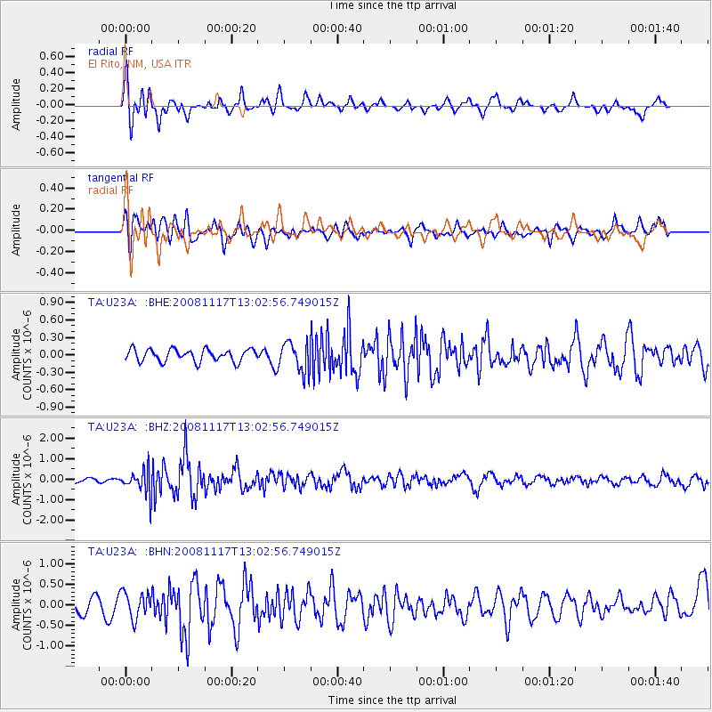
Signal To Noise
| Channel | StoN | STA | LTA |
| TA:U23A: :BHZ:20081117T13:02:56.749015Z | 2.9074092 | 5.9106685E-7 | 2.0329676E-7 |
| TA:U23A: :BHN:20081117T13:02:56.749015Z | 1.5883919 | 3.193184E-7 | 2.010325E-7 |
| TA:U23A: :BHE:20081117T13:02:56.749015Z | 2.401249 | 2.516973E-7 | 1.0481933E-7 |
| Arrivals |
| Ps | |
| PpPs | |
| PsPs/PpSs | |


