You are here: Home > Network List > CI - Caltech Regional Seismic Network Stations List
> Station MPM Manuel Prospect Mine, California, USA > Earthquake Result Viewer
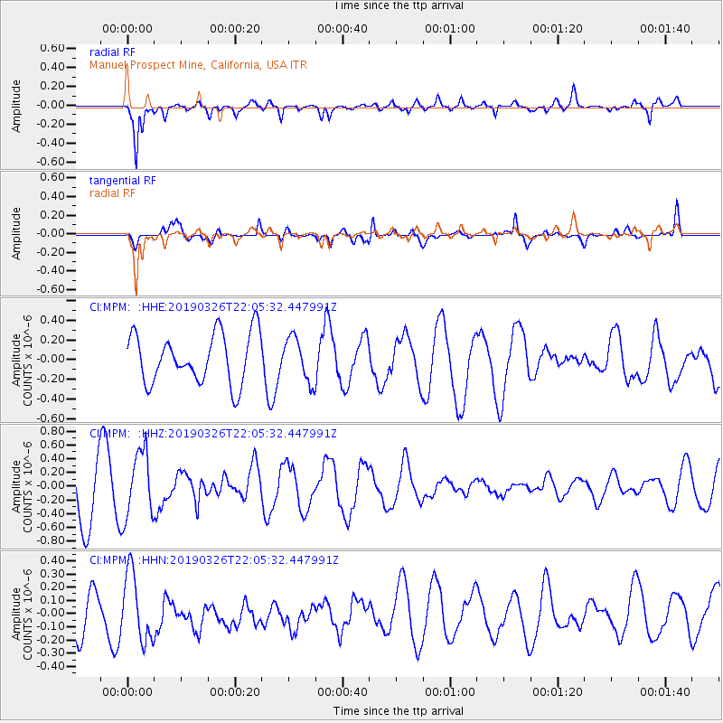
MPM Manuel Prospect Mine, California, USA - Earthquake Result Viewer
*The percent match for this event was below the threshold and hence no stack was calculated.
| Earthquake location: |
Tonga Islands |
| Earthquake latitude/longitude: |
-21.4/-173.4 |
| Earthquake time(UTC): |
2019/03/26 (085) 21:54:06 GMT |
| Earthquake Depth: |
10 km |
| Earthquake Magnitude: |
5.3 Mww |
| Earthquake Catalog/Contributor: |
NEIC PDE/us |
|
| Network: |
CI Caltech Regional Seismic Network |
| Station: |
MPM Manuel Prospect Mine, California, USA |
| Lat/Lon: |
36.06 N/117.49 W |
| Elevation: |
185 m |
|
| Distance: |
77.8 deg |
| Az: |
43.368 deg |
| Baz: |
232.178 deg |
| Ray Param: |
$rayparam |
*The percent match for this event was below the threshold and hence was not used in the summary stack. |
|
| Radial Match: |
85.523 % |
| Radial Bump: |
400 |
| Transverse Match: |
68.84274 % |
| Transverse Bump: |
400 |
| SOD ConfigId: |
13570011 |
| Insert Time: |
2019-05-02 19:36:07.803 +0000 |
| GWidth: |
2.5 |
| Max Bumps: |
400 |
| Tol: |
0.001 |
|
Signal To Noise
| Channel | StoN | STA | LTA |
| CI:MPM: :HHZ:20190326T22:05:32.447991Z | 1.3064735 | 4.7981337E-7 | 3.6725842E-7 |
| CI:MPM: :HHN:20190326T22:05:32.447991Z | 1.7700679 | 2.5798462E-7 | 1.4574844E-7 |
| CI:MPM: :HHE:20190326T22:05:32.447991Z | 0.89734685 | 2.248606E-7 | 2.505838E-7 |
| Arrivals |
| Ps | |
| PpPs | |
| PsPs/PpSs | |


