You are here: Home > Network List > TA - USArray Transportable Network (new EarthScope stations) Stations List
> Station F21K Alatna River, AK, USA > Earthquake Result Viewer
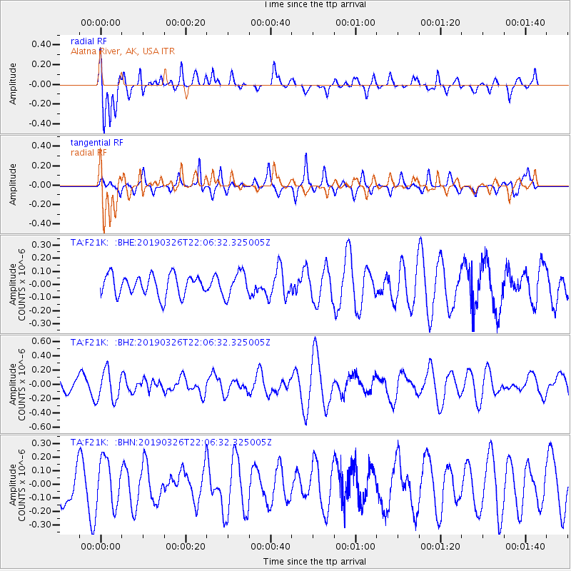
F21K Alatna River, AK, USA - Earthquake Result Viewer
*The percent match for this event was below the threshold and hence no stack was calculated.
| Earthquake location: |
Tonga Islands |
| Earthquake latitude/longitude: |
-21.4/-173.4 |
| Earthquake time(UTC): |
2019/03/26 (085) 21:54:06 GMT |
| Earthquake Depth: |
10 km |
| Earthquake Magnitude: |
5.3 Mww |
| Earthquake Catalog/Contributor: |
NEIC PDE/us |
|
| Network: |
TA USArray Transportable Network (new EarthScope stations) |
| Station: |
F21K Alatna River, AK, USA |
| Lat/Lon: |
67.22 N/153.48 W |
| Elevation: |
597 m |
|
| Distance: |
89.6 deg |
| Az: |
7.631 deg |
| Baz: |
198.535 deg |
| Ray Param: |
$rayparam |
*The percent match for this event was below the threshold and hence was not used in the summary stack. |
|
| Radial Match: |
76.35809 % |
| Radial Bump: |
353 |
| Transverse Match: |
42.243164 % |
| Transverse Bump: |
323 |
| SOD ConfigId: |
13570011 |
| Insert Time: |
2019-05-02 19:38:56.064 +0000 |
| GWidth: |
2.5 |
| Max Bumps: |
400 |
| Tol: |
0.001 |
|
Signal To Noise
| Channel | StoN | STA | LTA |
| TA:F21K: :BHZ:20190326T22:06:32.325005Z | 2.1930885 | 2.075699E-7 | 9.46473E-8 |
| TA:F21K: :BHN:20190326T22:06:32.325005Z | 1.5767908 | 1.6994518E-7 | 1.0777916E-7 |
| TA:F21K: :BHE:20190326T22:06:32.325005Z | 1.2178123 | 9.544192E-8 | 7.837161E-8 |
| Arrivals |
| Ps | |
| PpPs | |
| PsPs/PpSs | |


