You are here: Home > Network List > TA - USArray Transportable Network (new EarthScope stations) Stations List
> Station U23A El Rito, NM, USA > Earthquake Result Viewer
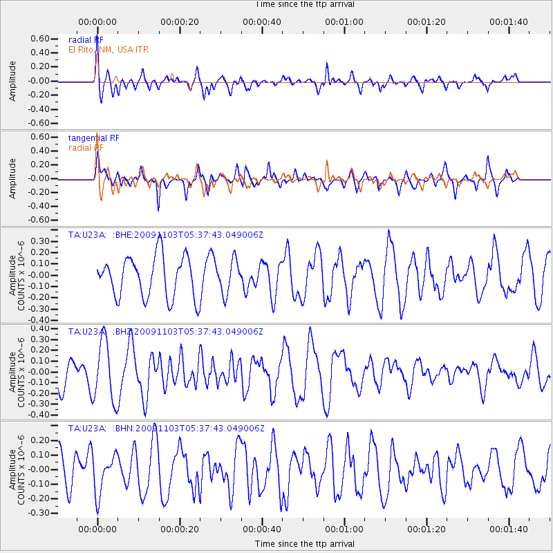
U23A El Rito, NM, USA - Earthquake Result Viewer
*The percent match for this event was below the threshold and hence no stack was calculated.
| Earthquake location: |
Ionian Sea |
| Earthquake latitude/longitude: |
37.5/20.5 |
| Earthquake time(UTC): |
2009/11/03 (307) 05:25:08 GMT |
| Earthquake Depth: |
10 km |
| Earthquake Magnitude: |
5.5 MB, 5.3 MS, 5.8 MW, 5.7 MW |
| Earthquake Catalog/Contributor: |
WHDF/NEIC |
|
| Network: |
TA USArray Transportable Network (new EarthScope stations) |
| Station: |
U23A El Rito, NM, USA |
| Lat/Lon: |
36.33 N/106.19 W |
| Elevation: |
2093 m |
|
| Distance: |
91.5 deg |
| Az: |
319.623 deg |
| Baz: |
39.642 deg |
| Ray Param: |
$rayparam |
*The percent match for this event was below the threshold and hence was not used in the summary stack. |
|
| Radial Match: |
53.117855 % |
| Radial Bump: |
400 |
| Transverse Match: |
50.71208 % |
| Transverse Bump: |
400 |
| SOD ConfigId: |
2622 |
| Insert Time: |
2010-03-06 21:00:07.627 +0000 |
| GWidth: |
2.5 |
| Max Bumps: |
400 |
| Tol: |
0.001 |
|
Signal To Noise
| Channel | StoN | STA | LTA |
| TA:U23A: :BHZ:20091103T05:37:43.049006Z | 2.4172041 | 2.843462E-7 | 1.1763434E-7 |
| TA:U23A: :BHN:20091103T05:37:43.049006Z | 0.909548 | 1.3304732E-7 | 1.462785E-7 |
| TA:U23A: :BHE:20091103T05:37:43.049006Z | 0.7956132 | 1.4457424E-7 | 1.8171423E-7 |
| Arrivals |
| Ps | |
| PpPs | |
| PsPs/PpSs | |


