You are here: Home > Network List > TA - USArray Transportable Network (new EarthScope stations) Stations List
> Station U23A El Rito, NM, USA > Earthquake Result Viewer
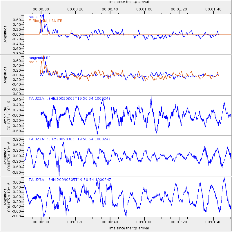
U23A El Rito, NM, USA - Earthquake Result Viewer
*The percent match for this event was below the threshold and hence no stack was calculated.
| Earthquake location: |
North Of Svalbard |
| Earthquake latitude/longitude: |
80.3/-1.8 |
| Earthquake time(UTC): |
2009/03/05 (064) 19:41:40 GMT |
| Earthquake Depth: |
10 km |
| Earthquake Magnitude: |
5.5 MB, 5.0 MS, 5.4 MW |
| Earthquake Catalog/Contributor: |
WHDF/NEIC |
|
| Network: |
TA USArray Transportable Network (new EarthScope stations) |
| Station: |
U23A El Rito, NM, USA |
| Lat/Lon: |
36.33 N/106.19 W |
| Elevation: |
2093 m |
|
| Distance: |
56.8 deg |
| Az: |
290.825 deg |
| Baz: |
11.339 deg |
| Ray Param: |
$rayparam |
*The percent match for this event was below the threshold and hence was not used in the summary stack. |
|
| Radial Match: |
75.61515 % |
| Radial Bump: |
400 |
| Transverse Match: |
75.88664 % |
| Transverse Bump: |
400 |
| SOD ConfigId: |
2658 |
| Insert Time: |
2010-03-06 21:00:13.641 +0000 |
| GWidth: |
2.5 |
| Max Bumps: |
400 |
| Tol: |
0.001 |
|
Signal To Noise
| Channel | StoN | STA | LTA |
| TA:U23A: :BHZ:20090305T19:50:54.100024Z | 0.8430569 | 3.5861407E-7 | 4.253735E-7 |
| TA:U23A: :BHN:20090305T19:50:54.100024Z | 1.014229 | 4.5573256E-7 | 4.4933893E-7 |
| TA:U23A: :BHE:20090305T19:50:54.100024Z | 1.6518493 | 3.425013E-7 | 2.0734416E-7 |
| Arrivals |
| Ps | |
| PpPs | |
| PsPs/PpSs | |


