You are here: Home > Network List > TA - USArray Transportable Network (new EarthScope stations) Stations List
> Station U23A El Rito, NM, USA > Earthquake Result Viewer
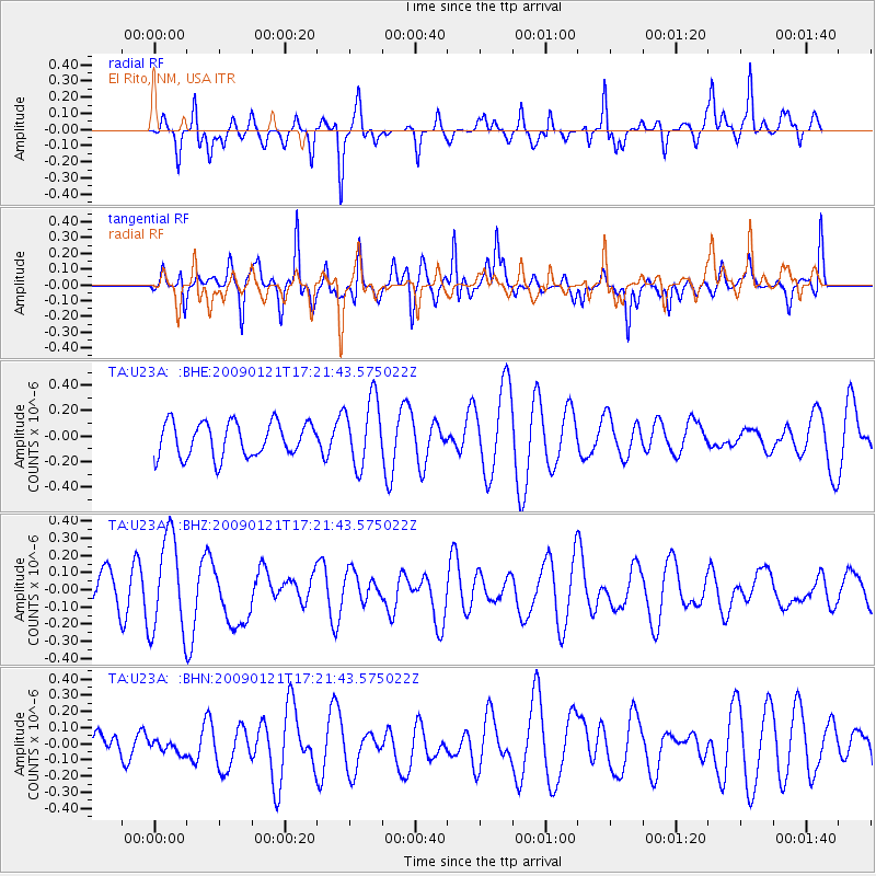
U23A El Rito, NM, USA - Earthquake Result Viewer
*The percent match for this event was below the threshold and hence no stack was calculated.
| Earthquake location: |
Southeast Of Loyalty Islands |
| Earthquake latitude/longitude: |
-22.7/171.0 |
| Earthquake time(UTC): |
2009/01/21 (021) 17:08:42 GMT |
| Earthquake Depth: |
24 km |
| Earthquake Magnitude: |
5.8 MS, 5.4 MB, 6.1 MW, 6.1 MW |
| Earthquake Catalog/Contributor: |
WHDF/NEIC |
|
| Network: |
TA USArray Transportable Network (new EarthScope stations) |
| Station: |
U23A El Rito, NM, USA |
| Lat/Lon: |
36.33 N/106.19 W |
| Elevation: |
2093 m |
|
| Distance: |
97.6 deg |
| Az: |
53.92 deg |
| Baz: |
247.563 deg |
| Ray Param: |
$rayparam |
*The percent match for this event was below the threshold and hence was not used in the summary stack. |
|
| Radial Match: |
51.30879 % |
| Radial Bump: |
334 |
| Transverse Match: |
66.648674 % |
| Transverse Bump: |
371 |
| SOD ConfigId: |
2834 |
| Insert Time: |
2010-03-06 21:00:41.773 +0000 |
| GWidth: |
2.5 |
| Max Bumps: |
400 |
| Tol: |
0.001 |
|
Signal To Noise
| Channel | StoN | STA | LTA |
| TA:U23A: :BHZ:20090121T17:21:43.575022Z | 3.6681616 | 2.7915135E-7 | 7.610116E-8 |
| TA:U23A: :BHN:20090121T17:21:43.575022Z | 0.34635806 | 5.8513514E-8 | 1.6893938E-7 |
| TA:U23A: :BHE:20090121T17:21:43.575022Z | 1.9877391 | 2.658608E-7 | 1.3375035E-7 |
| Arrivals |
| Ps | |
| PpPs | |
| PsPs/PpSs | |


