You are here: Home > Network List > CI - Caltech Regional Seismic Network Stations List
> Station SMM Simmler, CA, USA > Earthquake Result Viewer
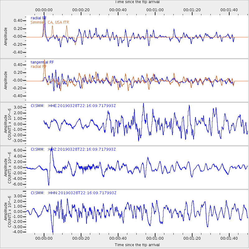
SMM Simmler, CA, USA - Earthquake Result Viewer
*The percent match for this event was below the threshold and hence no stack was calculated.
| Earthquake location: |
East Of Kuril Islands |
| Earthquake latitude/longitude: |
50.5/160.0 |
| Earthquake time(UTC): |
2019/03/28 (087) 22:06:49 GMT |
| Earthquake Depth: |
9.0 km |
| Earthquake Magnitude: |
6.2 Mww |
| Earthquake Catalog/Contributor: |
NEIC PDE/us |
|
| Network: |
CI Caltech Regional Seismic Network |
| Station: |
SMM Simmler, CA, USA |
| Lat/Lon: |
35.31 N/120.00 W |
| Elevation: |
599 m |
|
| Distance: |
57.8 deg |
| Az: |
72.198 deg |
| Baz: |
311.973 deg |
| Ray Param: |
$rayparam |
*The percent match for this event was below the threshold and hence was not used in the summary stack. |
|
| Radial Match: |
71.09165 % |
| Radial Bump: |
400 |
| Transverse Match: |
69.83176 % |
| Transverse Bump: |
400 |
| SOD ConfigId: |
13570011 |
| Insert Time: |
2019-05-02 19:51:18.816 +0000 |
| GWidth: |
2.5 |
| Max Bumps: |
400 |
| Tol: |
0.001 |
|
Signal To Noise
| Channel | StoN | STA | LTA |
| CI:SMM: :HHZ:20190328T22:16:09.717993Z | 11.892009 | 3.6365143E-6 | 3.0579477E-7 |
| CI:SMM: :HHN:20190328T22:16:09.717993Z | 4.0841556 | 1.4567414E-6 | 3.5668117E-7 |
| CI:SMM: :HHE:20190328T22:16:09.717993Z | 2.0496452 | 1.041732E-6 | 5.082499E-7 |
| Arrivals |
| Ps | |
| PpPs | |
| PsPs/PpSs | |


