You are here: Home > Network List > IU - Global Seismograph Network (GSN - IRIS/USGS) Stations List
> Station CTAO Charters Towers, Australia > Earthquake Result Viewer
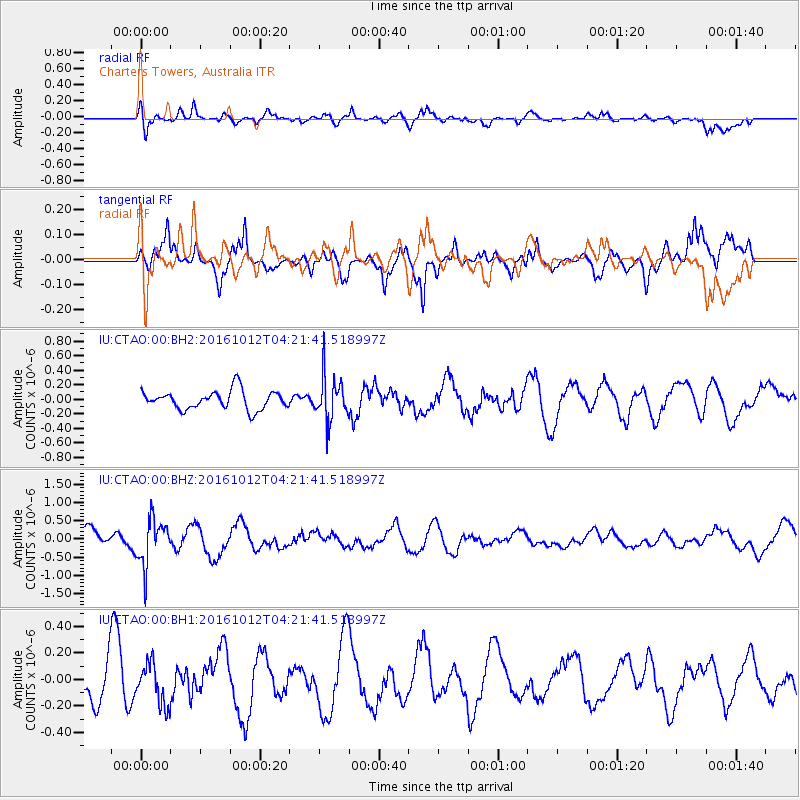
CTAO Charters Towers, Australia - Earthquake Result Viewer
*The percent match for this event was below the threshold and hence no stack was calculated.
| Earthquake location: |
Fiji Islands Region |
| Earthquake latitude/longitude: |
-20.9/-178.6 |
| Earthquake time(UTC): |
2016/10/12 (286) 04:16:24 GMT |
| Earthquake Depth: |
575 km |
| Earthquake Magnitude: |
5.5 MB |
| Earthquake Catalog/Contributor: |
NEIC PDE/NEIC COMCAT |
|
| Network: |
IU Global Seismograph Network (GSN - IRIS/USGS) |
| Station: |
CTAO Charters Towers, Australia |
| Lat/Lon: |
20.09 S/146.25 E |
| Elevation: |
357 m |
|
| Distance: |
32.9 deg |
| Az: |
265.081 deg |
| Baz: |
97.677 deg |
| Ray Param: |
$rayparam |
*The percent match for this event was below the threshold and hence was not used in the summary stack. |
|
| Radial Match: |
68.04681 % |
| Radial Bump: |
400 |
| Transverse Match: |
67.51185 % |
| Transverse Bump: |
400 |
| SOD ConfigId: |
1634031 |
| Insert Time: |
2016-10-26 04:17:44.701 +0000 |
| GWidth: |
2.5 |
| Max Bumps: |
400 |
| Tol: |
0.001 |
|
Signal To Noise
| Channel | StoN | STA | LTA |
| IU:CTAO:00:BHZ:20161012T04:21:41.518997Z | 2.5385916 | 6.2338734E-7 | 2.4556422E-7 |
| IU:CTAO:00:BH1:20161012T04:21:41.518997Z | 0.95647013 | 1.5218436E-7 | 1.5911041E-7 |
| IU:CTAO:00:BH2:20161012T04:21:41.518997Z | 2.2729309 | 2.9477832E-7 | 1.2969085E-7 |
| Arrivals |
| Ps | |
| PpPs | |
| PsPs/PpSs | |


