You are here: Home > Network List > CN - Canadian National Seismograph Network Stations List
> Station FRB IQALUIT, N.W.T. > Earthquake Result Viewer
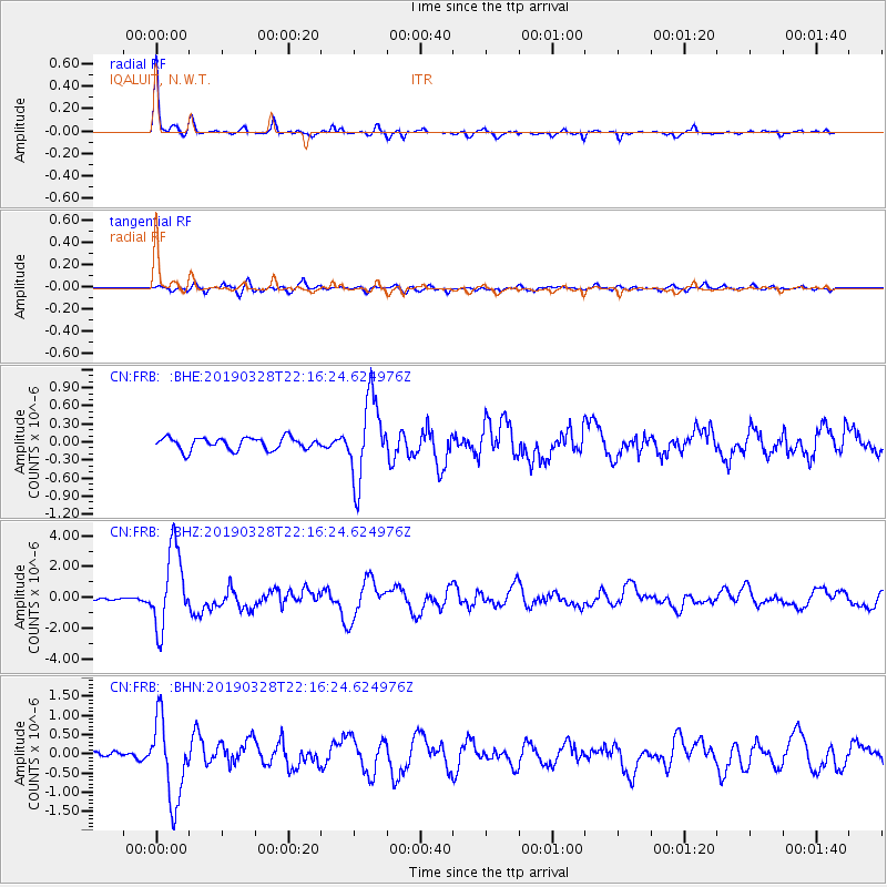
FRB IQALUIT, N.W.T. - Earthquake Result Viewer

| Earthquake location: |
East Of Kuril Islands |
| Earthquake latitude/longitude: |
50.5/160.0 |
| Earthquake time(UTC): |
2019/03/28 (087) 22:06:49 GMT |
| Earthquake Depth: |
9.0 km |
| Earthquake Magnitude: |
6.2 Mww |
| Earthquake Catalog/Contributor: |
NEIC PDE/us |
|
| Network: |
CN Canadian National Seismograph Network |
| Station: |
FRB IQALUIT, N.W.T. |
| Lat/Lon: |
63.75 N/68.55 W |
| Elevation: |
18 m |
|
| Distance: |
59.9 deg |
| Az: |
22.641 deg |
| Baz: |
326.444 deg |
| Ray Param: |
0.061870243 |
| Estimated Moho Depth: |
43.5 km |
| Estimated Crust Vp/Vs: |
1.78 |
| Assumed Crust Vp: |
6.419 km/s |
| Estimated Crust Vs: |
3.601 km/s |
| Estimated Crust Poisson's Ratio: |
0.27 |
|
| Radial Match: |
93.9731 % |
| Radial Bump: |
302 |
| Transverse Match: |
80.26281 % |
| Transverse Bump: |
400 |
| SOD ConfigId: |
13570011 |
| Insert Time: |
2019-05-02 19:51:50.126 +0000 |
| GWidth: |
2.5 |
| Max Bumps: |
400 |
| Tol: |
0.001 |
|
Signal To Noise
| Channel | StoN | STA | LTA |
| CN:FRB: :BHZ:20190328T22:16:24.624976Z | 15.998285 | 2.5313736E-6 | 1.582278E-7 |
| CN:FRB: :BHN:20190328T22:16:24.624976Z | 14.226846 | 1.0542764E-6 | 7.410471E-8 |
| CN:FRB: :BHE:20190328T22:16:24.624976Z | 6.6160965 | 6.704234E-7 | 1.0133217E-7 |
| Arrivals |
| Ps | 5.6 SECOND |
| PpPs | 18 SECOND |
| PsPs/PpSs | 24 SECOND |


