You are here: Home > Network List > US - United States National Seismic Network Stations List
> Station DGMT Dagmar, Montana, USA > Earthquake Result Viewer
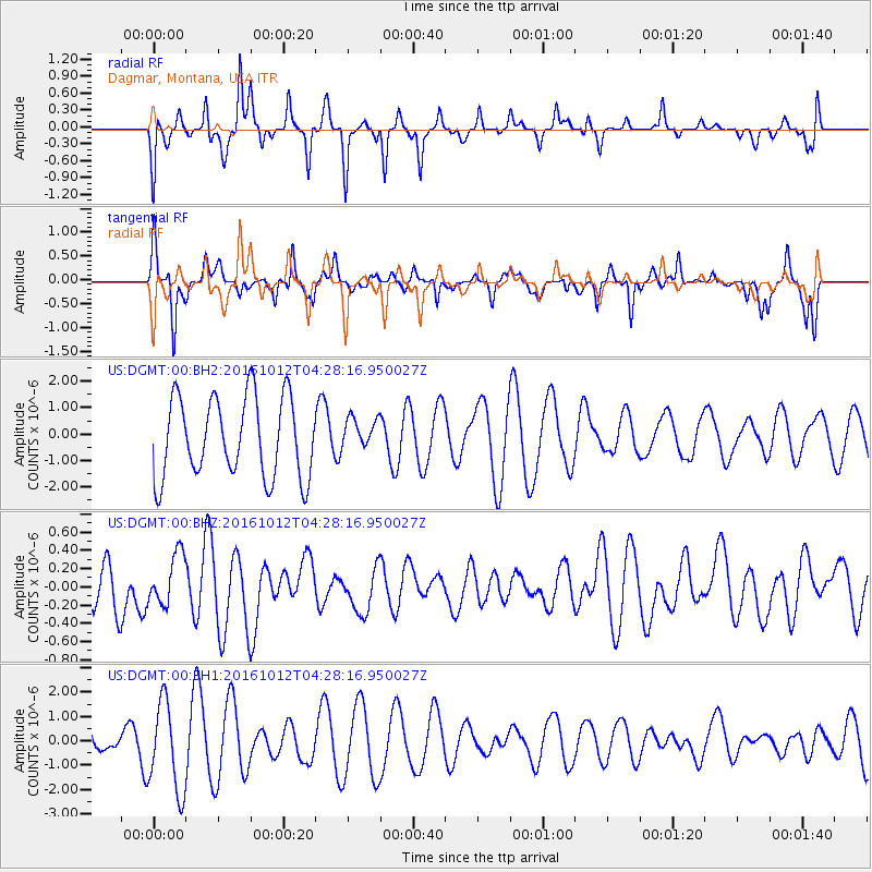
DGMT Dagmar, Montana, USA - Earthquake Result Viewer
*The percent match for this event was below the threshold and hence no stack was calculated.
| Earthquake location: |
Fiji Islands Region |
| Earthquake latitude/longitude: |
-20.9/-178.6 |
| Earthquake time(UTC): |
2016/10/12 (286) 04:16:24 GMT |
| Earthquake Depth: |
575 km |
| Earthquake Magnitude: |
5.5 MB |
| Earthquake Catalog/Contributor: |
NEIC PDE/NEIC COMCAT |
|
| Network: |
US United States National Seismic Network |
| Station: |
DGMT Dagmar, Montana, USA |
| Lat/Lon: |
48.47 N/104.20 W |
| Elevation: |
0.0 m |
|
| Distance: |
95.6 deg |
| Az: |
40.088 deg |
| Baz: |
244.777 deg |
| Ray Param: |
$rayparam |
*The percent match for this event was below the threshold and hence was not used in the summary stack. |
|
| Radial Match: |
32.720406 % |
| Radial Bump: |
283 |
| Transverse Match: |
45.663612 % |
| Transverse Bump: |
296 |
| SOD ConfigId: |
1634031 |
| Insert Time: |
2016-10-26 04:18:19.360 +0000 |
| GWidth: |
2.5 |
| Max Bumps: |
400 |
| Tol: |
0.001 |
|
Signal To Noise
| Channel | StoN | STA | LTA |
| US:DGMT:00:BHZ:20161012T04:28:16.950027Z | 0.8916881 | 2.765905E-7 | 3.101875E-7 |
| US:DGMT:00:BH1:20161012T04:28:16.950027Z | 2.0801694 | 1.8345049E-6 | 8.819017E-7 |
| US:DGMT:00:BH2:20161012T04:28:16.950027Z | 0.3979842 | 6.015295E-7 | 1.5114407E-6 |
| Arrivals |
| Ps | |
| PpPs | |
| PsPs/PpSs | |


