DGR Domenigoni Valley Reservior, California, USA - Earthquake Result Viewer
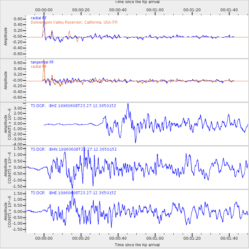
Earthquake location: Andreanof Islands, Aleutian Is.
Earthquake latitude/longitude: 51.5/-178.1
Earthquake time(UTC): 1996/06/08 (160) 23:19:15 GMT
Earthquake Depth: 33 km
Earthquake Magnitude: 5.9 MB, 6.3 MS, 6.5 UNKNOWN, 6.1 MS
Earthquake Catalog/Contributor: WHDF/NEIC
Network: TS TERRAscope (Southern California Seismic Network)
Station: DGR Domenigoni Valley Reservior, California, USA
Lat/Lon: 33.65 N/117.01 W
Elevation: 700 m
Distance: 47.0 deg
Az: 87.618 deg
Baz: 311.509 deg
Ray Param: 0.070232354
Estimated Moho Depth: 43.0 km
Estimated Crust Vp/Vs: 1.60
Assumed Crust Vp: 6.264 km/s
Estimated Crust Vs: 3.915 km/s
Estimated Crust Poisson's Ratio: 0.18
Radial Match: 94.11598 %
Radial Bump: 396
Transverse Match: 79.59422 %
Transverse Bump: 400
SOD ConfigId: 6273
Insert Time: 2010-02-26 14:08:59.822 +0000
GWidth: 2.5
Max Bumps: 400
Tol: 0.001

Signal To Noise

ChannelStoNSTALTA
TS:DGR: :BHN:19960608T23:27:12.365015Z4.10778053.6323559E-78.842623E-8
TS:DGR: :BHE:19960608T23:27:12.365015Z2.8405682.7245065E-79.5914146E-8
TS:DGR: :BHZ:19960608T23:27:12.365015Z11.0815917.6774063E-76.928072E-8
Arrivals
Ps4.4 SECOND
PpPs17 SECOND
PsPs/PpSs21 SECOND