M24A Cheyenne, WY, USA - Earthquake Result Viewer
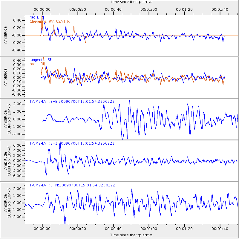
Earthquake location: Rat Islands, Aleutian Islands
Earthquake latitude/longitude: 50.4/177.0
Earthquake time(UTC): 2009/07/06 (187) 14:53:12 GMT
Earthquake Depth: 22 km
Earthquake Magnitude: 6.0 MB, 5.8 MS, 6.1 MW, 6.0 MW
Earthquake Catalog/Contributor: WHDF/NEIC
Network: TA USArray Transportable Network (new EarthScope stations)
Station: M24A Cheyenne, WY, USA
Lat/Lon: 41.47 N/104.82 W
Elevation: 1816 m
Distance: 52.7 deg
Az: 67.576 deg
Baz: 308.133 deg
Ray Param: 0.06654378
Estimated Moho Depth: 20.25 km
Estimated Crust Vp/Vs: 1.96
Assumed Crust Vp: 6.306 km/s
Estimated Crust Vs: 3.217 km/s
Estimated Crust Poisson's Ratio: 0.32
Radial Match: 81.600266 %
Radial Bump: 400
Transverse Match: 79.12275 %
Transverse Bump: 400
SOD ConfigId: 2622
Insert Time: 2010-03-06 21:03:30.213 +0000
GWidth: 2.5
Max Bumps: 400
Tol: 0.001

Signal To Noise

ChannelStoNSTALTA
TA:M24A: :BHZ:20090706T15:01:54.325022Z8.8039552.7141361E-63.08286E-7
TA:M24A: :BHN:20090706T15:01:54.325022Z1.91161637.431829E-73.88772E-7
TA:M24A: :BHE:20090706T15:01:54.325022Z3.04591068.3592505E-72.7444176E-7
Arrivals
Ps3.2 SECOND
PpPs9.1 SECOND
PsPs/PpSs12 SECOND