You are here: Home > Network List > TA - USArray Transportable Network (new EarthScope stations) Stations List
> Station M24A Cheyenne, WY, USA > Earthquake Result Viewer
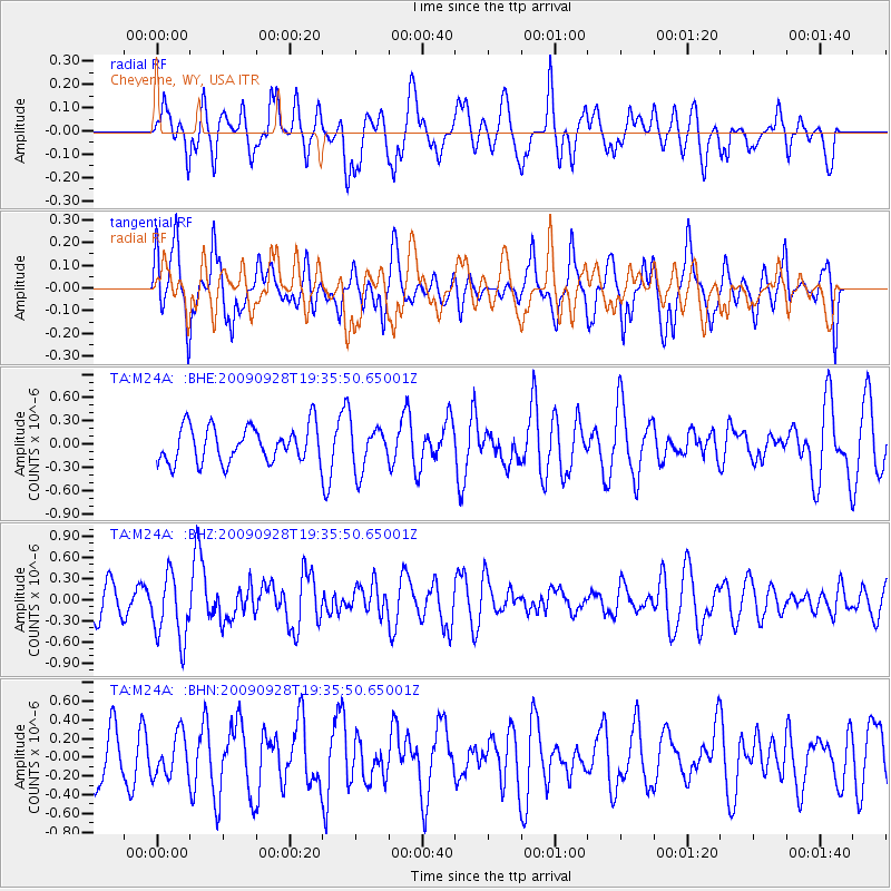
M24A Cheyenne, WY, USA - Earthquake Result Viewer
*The percent match for this event was below the threshold and hence no stack was calculated.
| Earthquake location: |
Ryukyu Islands, Japan |
| Earthquake latitude/longitude: |
27.9/127.8 |
| Earthquake time(UTC): |
2009/09/28 (271) 19:22:57 GMT |
| Earthquake Depth: |
9.0 km |
| Earthquake Magnitude: |
5.7 MB, 5.6 MS, 5.8 MW, 5.8 MW |
| Earthquake Catalog/Contributor: |
WHDF/NEIC |
|
| Network: |
TA USArray Transportable Network (new EarthScope stations) |
| Station: |
M24A Cheyenne, WY, USA |
| Lat/Lon: |
41.47 N/104.82 W |
| Elevation: |
1816 m |
|
| Distance: |
95.5 deg |
| Az: |
36.882 deg |
| Baz: |
315.038 deg |
| Ray Param: |
$rayparam |
*The percent match for this event was below the threshold and hence was not used in the summary stack. |
|
| Radial Match: |
54.48037 % |
| Radial Bump: |
400 |
| Transverse Match: |
52.82369 % |
| Transverse Bump: |
357 |
| SOD ConfigId: |
2622 |
| Insert Time: |
2010-03-06 21:04:24.408 +0000 |
| GWidth: |
2.5 |
| Max Bumps: |
400 |
| Tol: |
0.001 |
|
Signal To Noise
| Channel | StoN | STA | LTA |
| TA:M24A: :BHZ:20090928T19:35:50.65001Z | 2.8463886 | 4.6974432E-7 | 1.650317E-7 |
| TA:M24A: :BHN:20090928T19:35:50.65001Z | 0.8656879 | 2.2413023E-7 | 2.589042E-7 |
| TA:M24A: :BHE:20090928T19:35:50.65001Z | 1.2534182 | 2.8860046E-7 | 2.3025075E-7 |
| Arrivals |
| Ps | |
| PpPs | |
| PsPs/PpSs | |


