You are here: Home > Network List > TA - USArray Transportable Network (new EarthScope stations) Stations List
> Station M24A Cheyenne, WY, USA > Earthquake Result Viewer
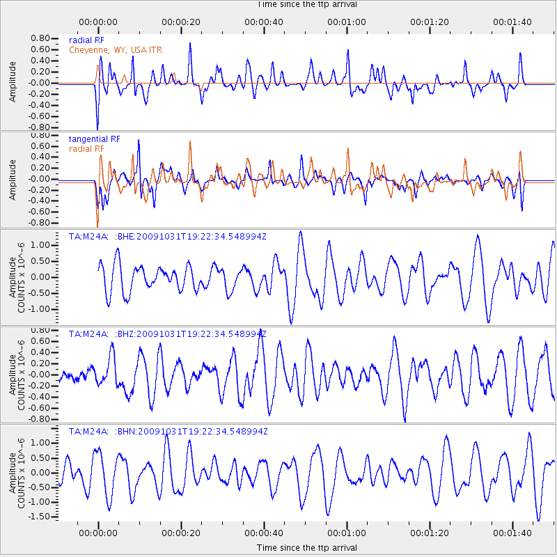
M24A Cheyenne, WY, USA - Earthquake Result Viewer
*The percent match for this event was below the threshold and hence no stack was calculated.
| Earthquake location: |
Santa Cruz Islands |
| Earthquake latitude/longitude: |
-11.4/166.4 |
| Earthquake time(UTC): |
2009/10/31 (304) 19:09:51 GMT |
| Earthquake Depth: |
134 km |
| Earthquake Magnitude: |
5.9 MB, 5.9 MW, 5.9 MW |
| Earthquake Catalog/Contributor: |
WHDF/NEIC |
|
| Network: |
TA USArray Transportable Network (new EarthScope stations) |
| Station: |
M24A Cheyenne, WY, USA |
| Lat/Lon: |
41.47 N/104.82 W |
| Elevation: |
1816 m |
|
| Distance: |
96.5 deg |
| Az: |
49.138 deg |
| Baz: |
260.683 deg |
| Ray Param: |
$rayparam |
*The percent match for this event was below the threshold and hence was not used in the summary stack. |
|
| Radial Match: |
60.885136 % |
| Radial Bump: |
400 |
| Transverse Match: |
56.24816 % |
| Transverse Bump: |
400 |
| SOD ConfigId: |
2622 |
| Insert Time: |
2010-03-06 21:04:36.983 +0000 |
| GWidth: |
2.5 |
| Max Bumps: |
400 |
| Tol: |
0.001 |
|
Signal To Noise
| Channel | StoN | STA | LTA |
| TA:M24A: :BHZ:20091031T19:22:34.548994Z | 1.0863521 | 2.6336633E-7 | 2.4243184E-7 |
| TA:M24A: :BHN:20091031T19:22:34.548994Z | 2.2844343 | 7.406645E-7 | 3.2422227E-7 |
| TA:M24A: :BHE:20091031T19:22:34.548994Z | 0.8429961 | 3.380934E-7 | 4.0106164E-7 |
| Arrivals |
| Ps | |
| PpPs | |
| PsPs/PpSs | |


