You are here: Home > Network List > TA - USArray Transportable Network (new EarthScope stations) Stations List
> Station M24A Cheyenne, WY, USA > Earthquake Result Viewer
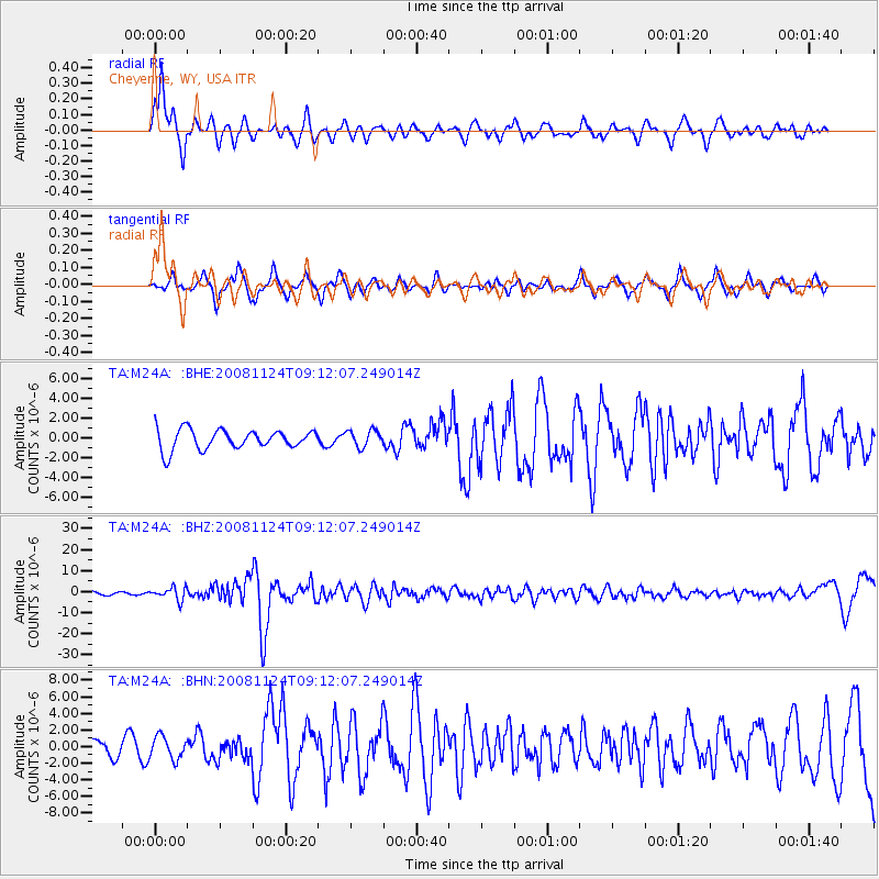
M24A Cheyenne, WY, USA - Earthquake Result Viewer
*The percent match for this event was below the threshold and hence no stack was calculated.
| Earthquake location: |
Sea Of Okhotsk |
| Earthquake latitude/longitude: |
54.2/154.3 |
| Earthquake time(UTC): |
2008/11/24 (329) 09:02:58 GMT |
| Earthquake Depth: |
492 km |
| Earthquake Magnitude: |
6.5 MB, 7.3 MW, 7.3 MW |
| Earthquake Catalog/Contributor: |
WHDF/NEIC |
|
| Network: |
TA USArray Transportable Network (new EarthScope stations) |
| Station: |
M24A Cheyenne, WY, USA |
| Lat/Lon: |
41.47 N/104.82 W |
| Elevation: |
1816 m |
|
| Distance: |
63.2 deg |
| Az: |
55.775 deg |
| Baz: |
319.732 deg |
| Ray Param: |
$rayparam |
*The percent match for this event was below the threshold and hence was not used in the summary stack. |
|
| Radial Match: |
76.42414 % |
| Radial Bump: |
400 |
| Transverse Match: |
67.952545 % |
| Transverse Bump: |
400 |
| SOD ConfigId: |
2658 |
| Insert Time: |
2010-03-06 21:04:40.866 +0000 |
| GWidth: |
2.5 |
| Max Bumps: |
400 |
| Tol: |
0.001 |
|
Signal To Noise
| Channel | StoN | STA | LTA |
| TA:M24A: :BHZ:20081124T09:12:07.249014Z | 3.657674 | 2.980216E-6 | 8.1478447E-7 |
| TA:M24A: :BHN:20081124T09:12:07.249014Z | 2.1650789 | 1.3455798E-6 | 6.2149223E-7 |
| TA:M24A: :BHE:20081124T09:12:07.249014Z | 0.8466626 | 8.563527E-7 | 1.0114451E-6 |
| Arrivals |
| Ps | |
| PpPs | |
| PsPs/PpSs | |


