You are here: Home > Network List > TA - USArray Transportable Network (new EarthScope stations) Stations List
> Station M24A Cheyenne, WY, USA > Earthquake Result Viewer
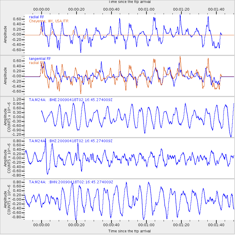
M24A Cheyenne, WY, USA - Earthquake Result Viewer
*The percent match for this event was below the threshold and hence no stack was calculated.
| Earthquake location: |
Kermadec Islands Region |
| Earthquake latitude/longitude: |
-28.9/-177.4 |
| Earthquake time(UTC): |
2009/04/18 (108) 02:03:52 GMT |
| Earthquake Depth: |
65 km |
| Earthquake Magnitude: |
6.0 MB, 5.8 MW, 5.7 MW |
| Earthquake Catalog/Contributor: |
WHDF/NEIC |
|
| Network: |
TA USArray Transportable Network (new EarthScope stations) |
| Station: |
M24A Cheyenne, WY, USA |
| Lat/Lon: |
41.47 N/104.82 W |
| Elevation: |
1816 m |
|
| Distance: |
96.9 deg |
| Az: |
46.26 deg |
| Baz: |
237.44 deg |
| Ray Param: |
$rayparam |
*The percent match for this event was below the threshold and hence was not used in the summary stack. |
|
| Radial Match: |
72.896675 % |
| Radial Bump: |
400 |
| Transverse Match: |
48.14783 % |
| Transverse Bump: |
400 |
| SOD ConfigId: |
2658 |
| Insert Time: |
2010-03-06 21:04:41.670 +0000 |
| GWidth: |
2.5 |
| Max Bumps: |
400 |
| Tol: |
0.001 |
|
Signal To Noise
| Channel | StoN | STA | LTA |
| TA:M24A: :BHZ:20090418T02:16:45.274009Z | 2.8134127 | 4.4640316E-7 | 1.5866964E-7 |
| TA:M24A: :BHN:20090418T02:16:45.274009Z | 0.7278274 | 1.700849E-7 | 2.336885E-7 |
| TA:M24A: :BHE:20090418T02:16:45.274009Z | 0.7613136 | 3.8788139E-7 | 5.0948967E-7 |
| Arrivals |
| Ps | |
| PpPs | |
| PsPs/PpSs | |


