You are here: Home > Network List > TA - USArray Transportable Network (new EarthScope stations) Stations List
> Station M24A Cheyenne, WY, USA > Earthquake Result Viewer
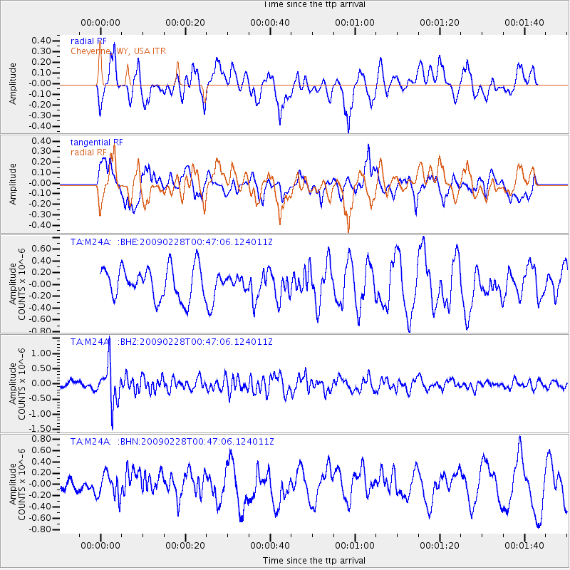
M24A Cheyenne, WY, USA - Earthquake Result Viewer
*The percent match for this event was below the threshold and hence no stack was calculated.
| Earthquake location: |
Hokkaido, Japan Region |
| Earthquake latitude/longitude: |
42.6/142.1 |
| Earthquake time(UTC): |
2009/02/28 (059) 00:35:56 GMT |
| Earthquake Depth: |
105 km |
| Earthquake Magnitude: |
5.5 MB, 5.5 MW, 5.5 MW |
| Earthquake Catalog/Contributor: |
WHDF/NEIC |
|
| Network: |
TA USArray Transportable Network (new EarthScope stations) |
| Station: |
M24A Cheyenne, WY, USA |
| Lat/Lon: |
41.47 N/104.82 W |
| Elevation: |
1816 m |
|
| Distance: |
76.8 deg |
| Az: |
45.239 deg |
| Baz: |
315.774 deg |
| Ray Param: |
$rayparam |
*The percent match for this event was below the threshold and hence was not used in the summary stack. |
|
| Radial Match: |
62.429398 % |
| Radial Bump: |
400 |
| Transverse Match: |
57.862587 % |
| Transverse Bump: |
400 |
| SOD ConfigId: |
2658 |
| Insert Time: |
2010-03-06 21:04:45.337 +0000 |
| GWidth: |
2.5 |
| Max Bumps: |
400 |
| Tol: |
0.001 |
|
Signal To Noise
| Channel | StoN | STA | LTA |
| TA:M24A: :BHZ:20090228T00:47:06.124011Z | 3.4362106 | 6.3269306E-7 | 1.8412521E-7 |
| TA:M24A: :BHN:20090228T00:47:06.124011Z | 1.0736449 | 2.1048257E-7 | 1.9604488E-7 |
| TA:M24A: :BHE:20090228T00:47:06.124011Z | 0.31498557 | 8.448418E-8 | 2.6821604E-7 |
| Arrivals |
| Ps | |
| PpPs | |
| PsPs/PpSs | |


