You are here: Home > Network List > TA - USArray Transportable Network (new EarthScope stations) Stations List
> Station M24A Cheyenne, WY, USA > Earthquake Result Viewer
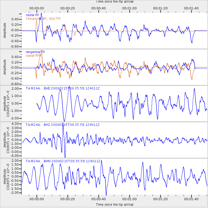
M24A Cheyenne, WY, USA - Earthquake Result Viewer
*The percent match for this event was below the threshold and hence no stack was calculated.
| Earthquake location: |
Near East Coast Of Honshu, Japan |
| Earthquake latitude/longitude: |
40.2/142.2 |
| Earthquake time(UTC): |
2009/02/15 (046) 09:24:31 GMT |
| Earthquake Depth: |
33 km |
| Earthquake Magnitude: |
6.1 MB, 5.5 MS, 5.7 MW, 5.7 MW |
| Earthquake Catalog/Contributor: |
WHDF/NEIC |
|
| Network: |
TA USArray Transportable Network (new EarthScope stations) |
| Station: |
M24A Cheyenne, WY, USA |
| Lat/Lon: |
41.47 N/104.82 W |
| Elevation: |
1816 m |
|
| Distance: |
78.4 deg |
| Az: |
44.944 deg |
| Baz: |
313.984 deg |
| Ray Param: |
$rayparam |
*The percent match for this event was below the threshold and hence was not used in the summary stack. |
|
| Radial Match: |
53.44875 % |
| Radial Bump: |
400 |
| Transverse Match: |
34.32753 % |
| Transverse Bump: |
395 |
| SOD ConfigId: |
2658 |
| Insert Time: |
2010-03-06 21:05:38.224 +0000 |
| GWidth: |
2.5 |
| Max Bumps: |
400 |
| Tol: |
0.001 |
|
Signal To Noise
| Channel | StoN | STA | LTA |
| TA:M24A: :BHZ:20090215T09:35:58.124011Z | 1.7519778 | 7.117296E-7 | 4.0624354E-7 |
| TA:M24A: :BHN:20090215T09:35:58.124011Z | 2.812174 | 1.0648359E-6 | 3.7865217E-7 |
| TA:M24A: :BHE:20090215T09:35:58.124011Z | 0.39760184 | 4.5597085E-7 | 1.1468027E-6 |
| Arrivals |
| Ps | |
| PpPs | |
| PsPs/PpSs | |


