You are here: Home > Network List > TA - USArray Transportable Network (new EarthScope stations) Stations List
> Station B18K Kokolik River, AK, USA > Earthquake Result Viewer
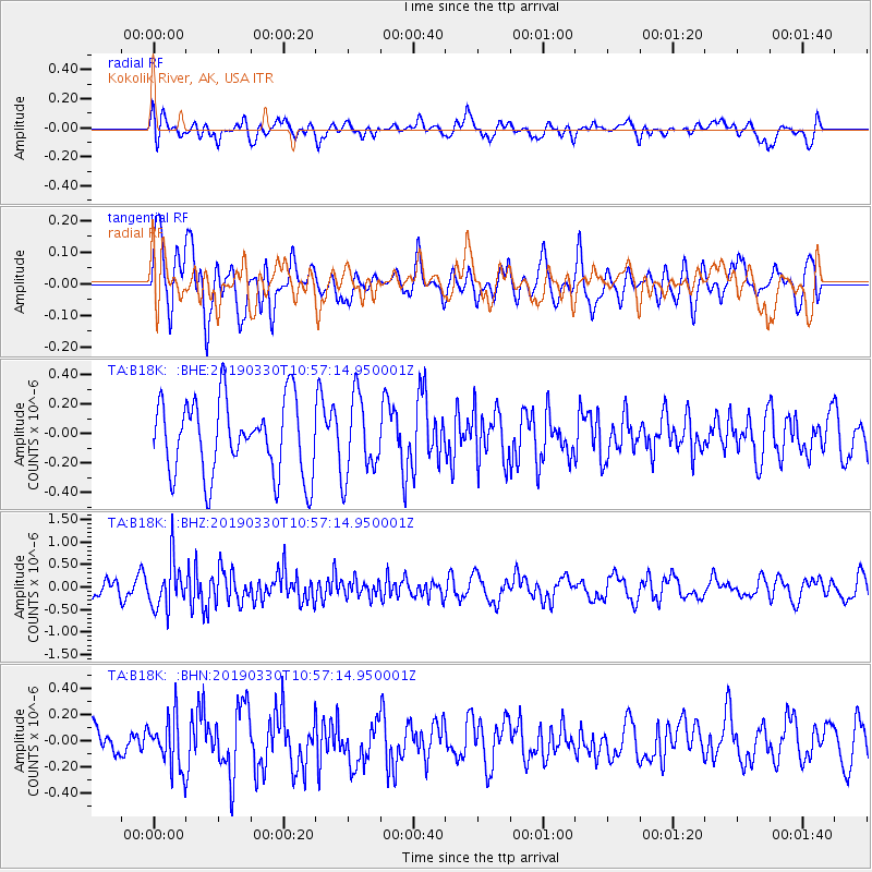
B18K Kokolik River, AK, USA - Earthquake Result Viewer
*The percent match for this event was below the threshold and hence no stack was calculated.
| Earthquake location: |
Greece |
| Earthquake latitude/longitude: |
38.4/22.4 |
| Earthquake time(UTC): |
2019/03/30 (089) 10:46:19 GMT |
| Earthquake Depth: |
10 km |
| Earthquake Magnitude: |
5.3 Mww |
| Earthquake Catalog/Contributor: |
NEIC PDE/us |
|
| Network: |
TA USArray Transportable Network (new EarthScope stations) |
| Station: |
B18K Kokolik River, AK, USA |
| Lat/Lon: |
69.36 N/161.80 W |
| Elevation: |
222 m |
|
| Distance: |
72.5 deg |
| Az: |
1.558 deg |
| Baz: |
356.544 deg |
| Ray Param: |
$rayparam |
*The percent match for this event was below the threshold and hence was not used in the summary stack. |
|
| Radial Match: |
47.83238 % |
| Radial Bump: |
400 |
| Transverse Match: |
49.84226 % |
| Transverse Bump: |
400 |
| SOD ConfigId: |
13570011 |
| Insert Time: |
2019-05-02 20:10:59.967 +0000 |
| GWidth: |
2.5 |
| Max Bumps: |
400 |
| Tol: |
0.001 |
|
Signal To Noise
| Channel | StoN | STA | LTA |
| TA:B18K: :BHZ:20190330T10:57:14.950001Z | 2.1062016 | 5.326994E-7 | 2.5291948E-7 |
| TA:B18K: :BHN:20190330T10:57:14.950001Z | 1.7349561 | 1.9797133E-7 | 1.141074E-7 |
| TA:B18K: :BHE:20190330T10:57:14.950001Z | 1.0662221 | 2.6963917E-7 | 2.5289214E-7 |
| Arrivals |
| Ps | |
| PpPs | |
| PsPs/PpSs | |


