You are here: Home > Network List > CN - Canadian National Seismograph Network Stations List
> Station INK INUVIK, NT > Earthquake Result Viewer
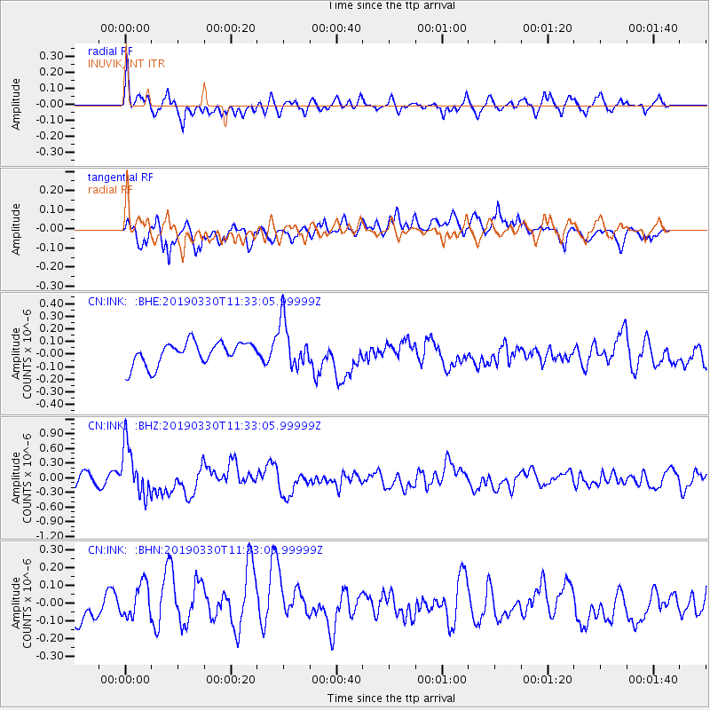
INK INUVIK, NT - Earthquake Result Viewer
*The percent match for this event was below the threshold and hence no stack was calculated.
| Earthquake location: |
New Britain Region, P.N.G. |
| Earthquake latitude/longitude: |
-5.7/151.1 |
| Earthquake time(UTC): |
2019/03/30 (089) 11:20:44 GMT |
| Earthquake Depth: |
57 km |
| Earthquake Magnitude: |
6.1 Mww |
| Earthquake Catalog/Contributor: |
NEIC PDE/us |
|
| Network: |
CN Canadian National Seismograph Network |
| Station: |
INK INUVIK, NT |
| Lat/Lon: |
68.31 N/133.53 W |
| Elevation: |
44 m |
|
| Distance: |
89.9 deg |
| Az: |
21.085 deg |
| Baz: |
254.357 deg |
| Ray Param: |
$rayparam |
*The percent match for this event was below the threshold and hence was not used in the summary stack. |
|
| Radial Match: |
75.566895 % |
| Radial Bump: |
400 |
| Transverse Match: |
53.06767 % |
| Transverse Bump: |
400 |
| SOD ConfigId: |
13570011 |
| Insert Time: |
2019-05-02 20:17:36.525 +0000 |
| GWidth: |
2.5 |
| Max Bumps: |
400 |
| Tol: |
0.001 |
|
Signal To Noise
| Channel | StoN | STA | LTA |
| CN:INK: :BHZ:20190330T11:33:05.99999Z | 4.980456 | 5.21871E-7 | 1.0478379E-7 |
| CN:INK: :BHN:20190330T11:33:05.99999Z | 1.7321949 | 1.1962713E-7 | 6.906102E-8 |
| CN:INK: :BHE:20190330T11:33:05.99999Z | 2.069142 | 1.876993E-7 | 9.0713584E-8 |
| Arrivals |
| Ps | |
| PpPs | |
| PsPs/PpSs | |


