DGR Domenigoni Valley Reservior, California, USA - Earthquake Result Viewer
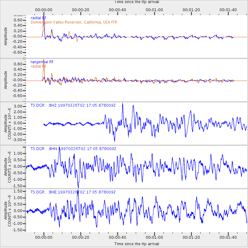
Earthquake location: Rat Islands, Aleutian Islands
Earthquake latitude/longitude: 51.3/179.5
Earthquake time(UTC): 1997/03/26 (085) 02:08:57 GMT
Earthquake Depth: 33 km
Earthquake Magnitude: 6.0 MB, 6.5 MS, 6.7 UNKNOWN, 6.3 ML
Earthquake Catalog/Contributor: WHDF/NEIC
Network: TS TERRAscope (Southern California Seismic Network)
Station: DGR Domenigoni Valley Reservior, California, USA
Lat/Lon: 33.65 N/117.01 W
Elevation: 700 m
Distance: 48.4 deg
Az: 85.679 deg
Baz: 311.335 deg
Ray Param: 0.06928877
Estimated Moho Depth: 23.75 km
Estimated Crust Vp/Vs: 2.10
Assumed Crust Vp: 6.264 km/s
Estimated Crust Vs: 2.99 km/s
Estimated Crust Poisson's Ratio: 0.35
Radial Match: 92.95032 %
Radial Bump: 373
Transverse Match: 74.10899 %
Transverse Bump: 400
SOD ConfigId: 9875
Insert Time: 2010-02-26 14:09:22.666 +0000
GWidth: 2.5
Max Bumps: 400
Tol: 0.001

Signal To Noise

ChannelStoNSTALTA
TS:DGR: :BHN:19970326T02:17:05.878009Z1.65185192.5681481E-71.5547084E-7
TS:DGR: :BHE:19970326T02:17:05.878009Z2.33661132.3984126E-71.02644904E-7
TS:DGR: :BHZ:19970326T02:17:05.878009Z3.88804345.441062E-71.3994345E-7
Arrivals
Ps4.4 SECOND
PpPs11 SECOND
PsPs/PpSs16 SECOND