
O25A Wiggins, CO, USA - Earthquake Result Viewer
| ||||||||||||||||||
| ||||||||||||||||||
| ||||||||||||||||||
|
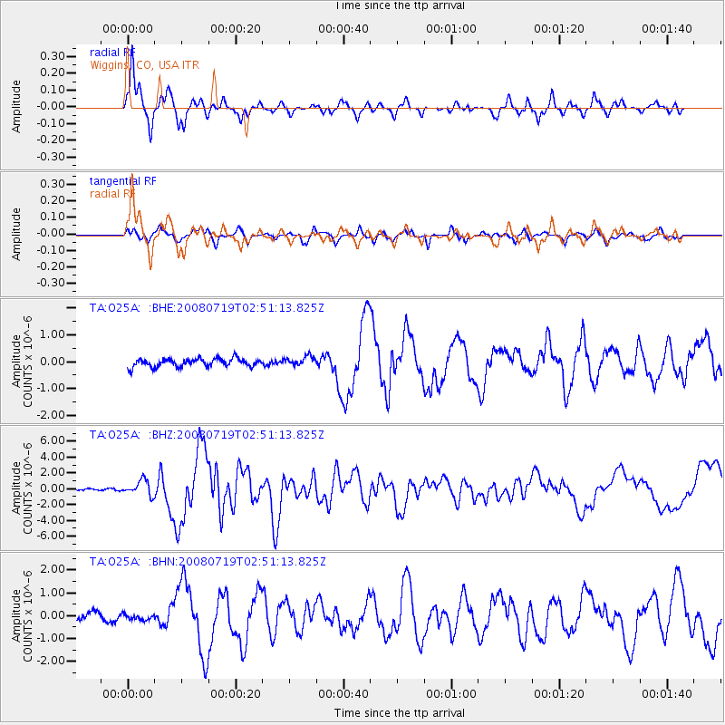
Signal To Noise
| Channel | StoN | STA | LTA |
| TA:O25A: :BHZ:20080719T02:51:13.825Z | 6.1000447 | 9.723017E-7 | 1.5939256E-7 |
| TA:O25A: :BHN:20080719T02:51:13.825Z | 0.7935165 | 1.283867E-7 | 1.6179462E-7 |
| TA:O25A: :BHE:20080719T02:51:13.825Z | 1.1091282 | 1.7000514E-7 | 1.5327817E-7 |
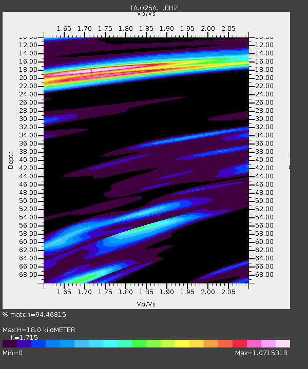
| Arrivals | |
| Ps | 2.1 SECOND |
| PpPs | 7.5 SECOND |
| PsPs/PpSs | 9.6 SECOND |

