
O25A Wiggins, CO, USA - Earthquake Result Viewer
| ||||||||||||||||||
| ||||||||||||||||||
| ||||||||||||||||||
|
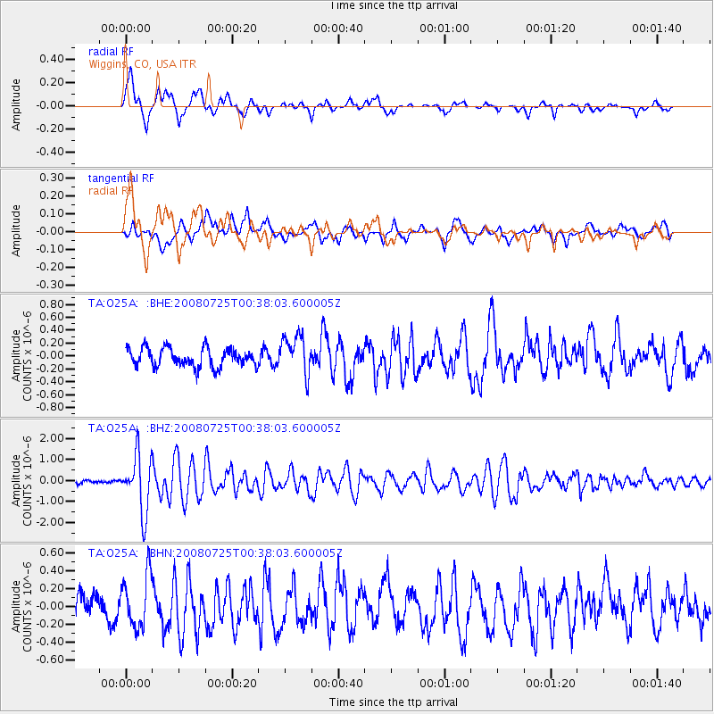
Signal To Noise
| Channel | StoN | STA | LTA |
| TA:O25A: :BHZ:20080725T00:38:03.600005Z | 12.1307125 | 1.3619083E-6 | 1.1226944E-7 |
| TA:O25A: :BHN:20080725T00:38:03.600005Z | 2.1044111 | 2.964069E-7 | 1.4085028E-7 |
| TA:O25A: :BHE:20080725T00:38:03.600005Z | 2.1258516 | 3.018513E-7 | 1.4199075E-7 |
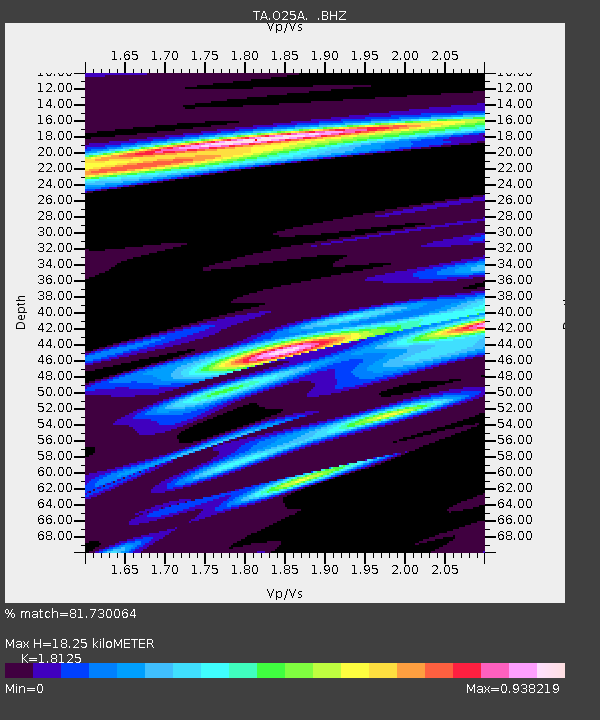
| Arrivals | |
| Ps | 2.5 SECOND |
| PpPs | 7.7 SECOND |
| PsPs/PpSs | 10 SECOND |

