O25A Wiggins, CO, USA - Earthquake Result Viewer
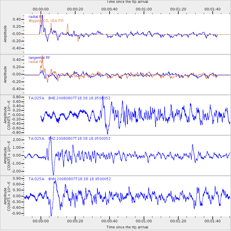
Earthquake location: Andreanof Islands, Aleutian Is.
Earthquake latitude/longitude: 52.2/-175.7
Earthquake time(UTC): 2008/08/07 (220) 18:30:03 GMT
Earthquake Depth: 12 km
Earthquake Magnitude: 5.6 MB, 5.5 MS, 5.8 MW, 5.8 MW
Earthquake Catalog/Contributor: WHDF/NEIC
Network: TA USArray Transportable Network (new EarthScope stations)
Station: O25A Wiggins, CO, USA
Lat/Lon: 40.11 N/104.12 W
Elevation: 1444 m
Distance: 49.1 deg
Az: 74.361 deg
Baz: 309.375 deg
Ray Param: 0.0689427
Estimated Moho Depth: 18.5 km
Estimated Crust Vp/Vs: 1.80
Assumed Crust Vp: 6.306 km/s
Estimated Crust Vs: 3.508 km/s
Estimated Crust Poisson's Ratio: 0.28
Radial Match: 84.12726 %
Radial Bump: 400
Transverse Match: 63.566925 %
Transverse Bump: 400
SOD ConfigId: 2504
Insert Time: 2010-03-06 21:08:18.883 +0000
GWidth: 2.5
Max Bumps: 400
Tol: 0.001

Signal To Noise

ChannelStoNSTALTA
TA:O25A: :BHZ:20080807T18:38:18.950005Z4.42731434.0218202E-79.084108E-8
TA:O25A: :BHN:20080807T18:38:18.950005Z2.02810361.4917329E-77.3553096E-8
TA:O25A: :BHE:20080807T18:38:18.950005Z1.35056291.707714E-71.264446E-7
Arrivals
Ps2.5 SECOND
PpPs7.8 SECOND
PsPs/PpSs10 SECOND