You are here: Home > Network List > UW - Pacific Northwest Regional Seismic Network Stations List
> Station UMAT Pilot Rock, OR, USA > Earthquake Result Viewer
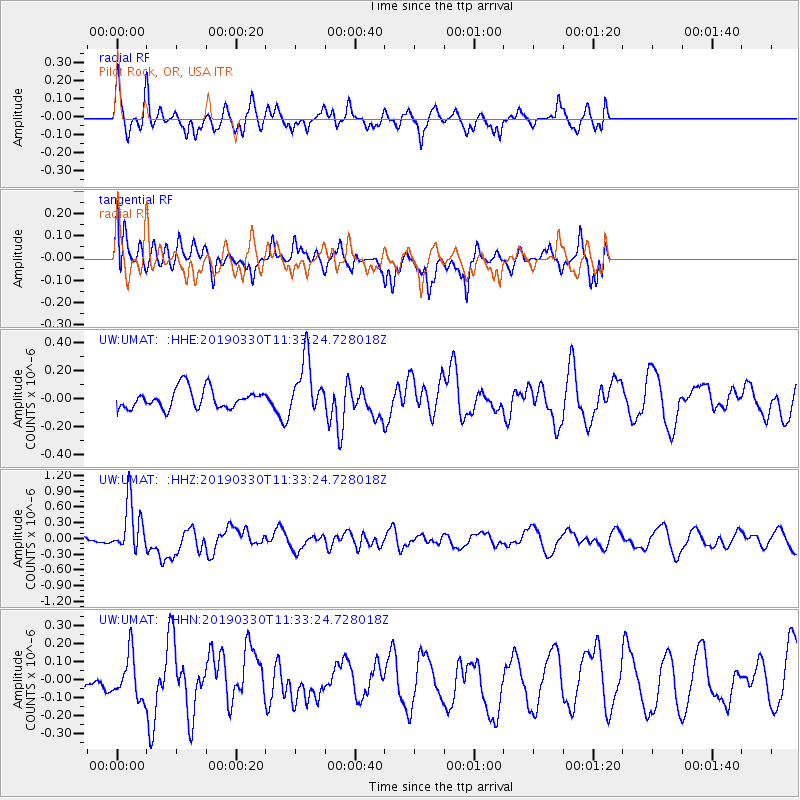
UMAT Pilot Rock, OR, USA - Earthquake Result Viewer
*The percent match for this event was below the threshold and hence no stack was calculated.
| Earthquake location: |
New Britain Region, P.N.G. |
| Earthquake latitude/longitude: |
-5.7/151.1 |
| Earthquake time(UTC): |
2019/03/30 (089) 11:20:44 GMT |
| Earthquake Depth: |
57 km |
| Earthquake Magnitude: |
6.1 Mww |
| Earthquake Catalog/Contributor: |
NEIC PDE/us |
|
| Network: |
UW Pacific Northwest Regional Seismic Network |
| Station: |
UMAT Pilot Rock, OR, USA |
| Lat/Lon: |
45.29 N/118.96 W |
| Elevation: |
1318 m |
|
| Distance: |
94.0 deg |
| Az: |
45.038 deg |
| Baz: |
265.98 deg |
| Ray Param: |
$rayparam |
*The percent match for this event was below the threshold and hence was not used in the summary stack. |
|
| Radial Match: |
58.597786 % |
| Radial Bump: |
331 |
| Transverse Match: |
38.82082 % |
| Transverse Bump: |
343 |
| SOD ConfigId: |
13570011 |
| Insert Time: |
2019-05-02 20:22:53.547 +0000 |
| GWidth: |
2.5 |
| Max Bumps: |
400 |
| Tol: |
0.001 |
|
Signal To Noise
| Channel | StoN | STA | LTA |
| UW:UMAT: :HHZ:20190330T11:33:24.728018Z | 3.1025217 | 4.7359063E-7 | 1.52647E-7 |
| UW:UMAT: :HHN:20190330T11:33:24.728018Z | 1.0229648 | 1.2037259E-7 | 1.1767031E-7 |
| UW:UMAT: :HHE:20190330T11:33:24.728018Z | 2.8263292 | 2.0014478E-7 | 7.0814394E-8 |
| Arrivals |
| Ps | |
| PpPs | |
| PsPs/PpSs | |


