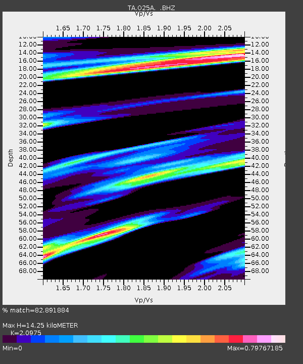
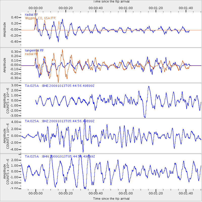
O25A Wiggins, CO, USA - Earthquake Result Viewer

Earthquake location: Fox Islands, Aleutian Islands
Earthquake latitude/longitude: 52.8/-167.0
Earthquake time(UTC): 2009/10/13 (286) 05:37:23 GMT
Earthquake Depth: 24 km
Earthquake Magnitude: 6.0 MB, 6.1 MS, 6.5 MW, 6.5 MW
Earthquake Catalog/Contributor: WHDF/NEIC
Network: TA USArray Transportable Network (new EarthScope stations)
Station: O25A Wiggins, CO, USA
Lat/Lon: 40.11 N/104.12 W
Elevation: 1444 m
Distance: 43.8 deg
Az: 80.646 deg
Baz: 308.554 deg
Ray Param: 0.07229659
Estimated Moho Depth: 14.25 km
Estimated Crust Vp/Vs: 2.10
Assumed Crust Vp: 6.306 km/s
Estimated Crust Vs: 3.006 km/s
Estimated Crust Poisson's Ratio: 0.35
Radial Match: 82.891884 %
Radial Bump: 400
Transverse Match: 50.89099 %
Transverse Bump: 359
SOD ConfigId: 2622
Insert Time: 2010-03-06 21:08:36.338 +0000
GWidth: 2.5
Max Bumps: 400
Tol: 0.001

Signal To Noise

ChannelStoNSTALTA
TA:O25A: :BHZ:20091013T05:44:56.49899Z2.29352056.8512645E-72.9872263E-7
TA:O25A: :BHN:20091013T05:44:56.49899Z0.64012416.2262376E-79.72661E-7
TA:O25A: :BHE:20091013T05:44:56.49899Z0.62296353.825961E-76.14155E-7
Arrivals
Ps2.6 SECOND
PpPs6.6 SECOND
PsPs/PpSs9.3 SECOND