You are here: Home > Network List > US - United States National Seismic Network Stations List
> Station HAWA Hanford, Washington, USA > Earthquake Result Viewer
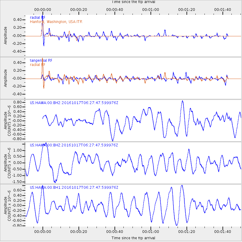
HAWA Hanford, Washington, USA - Earthquake Result Viewer
*The percent match for this event was below the threshold and hence no stack was calculated.
| Earthquake location: |
New Britain Region, P.N.G. |
| Earthquake latitude/longitude: |
-6.1/148.9 |
| Earthquake time(UTC): |
2016/10/17 (291) 06:14:58 GMT |
| Earthquake Depth: |
35 km |
| Earthquake Magnitude: |
6.9 MO |
| Earthquake Catalog/Contributor: |
NEIC PDE/NEIC ALERT |
|
| Network: |
US United States National Seismic Network |
| Station: |
HAWA Hanford, Washington, USA |
| Lat/Lon: |
46.39 N/119.53 W |
| Elevation: |
364 m |
|
| Distance: |
95.4 deg |
| Az: |
44.028 deg |
| Baz: |
266.984 deg |
| Ray Param: |
$rayparam |
*The percent match for this event was below the threshold and hence was not used in the summary stack. |
|
| Radial Match: |
58.0833 % |
| Radial Bump: |
400 |
| Transverse Match: |
45.79558 % |
| Transverse Bump: |
400 |
| SOD ConfigId: |
1634031 |
| Insert Time: |
2016-10-31 06:18:47.889 +0000 |
| GWidth: |
2.5 |
| Max Bumps: |
400 |
| Tol: |
0.001 |
|
Signal To Noise
| Channel | StoN | STA | LTA |
| US:HAWA:00:BHZ:20161017T06:27:47.599976Z | 2.6118443 | 1.1205906E-6 | 4.290419E-7 |
| US:HAWA:00:BH1:20161017T06:27:47.599976Z | 1.4739691 | 4.0127316E-7 | 2.7223987E-7 |
| US:HAWA:00:BH2:20161017T06:27:47.599976Z | 2.7626135 | 3.4408163E-7 | 1.2454932E-7 |
| Arrivals |
| Ps | |
| PpPs | |
| PsPs/PpSs | |


