I19A Meeteetse, WY, USA - Earthquake Result Viewer
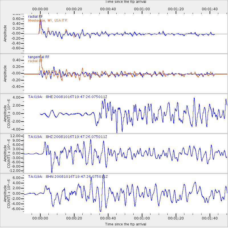
Earthquake location: Near Coast Of Chiapas, Mexico
Earthquake latitude/longitude: 14.4/-92.4
Earthquake time(UTC): 2008/10/16 (290) 19:41:25 GMT
Earthquake Depth: 24 km
Earthquake Magnitude: 6.1 MB, 6.6 MS, 6.7 MW, 6.6 MW
Earthquake Catalog/Contributor: WHDF/NEIC
Network: TA USArray Transportable Network (new EarthScope stations)
Station: I19A Meeteetse, WY, USA
Lat/Lon: 44.04 N/108.99 W
Elevation: 1982 m
Distance: 32.8 deg
Az: 337.572 deg
Baz: 149.167 deg
Ray Param: 0.07848893
Estimated Moho Depth: 37.0 km
Estimated Crust Vp/Vs: 1.84
Assumed Crust Vp: 6.242 km/s
Estimated Crust Vs: 3.397 km/s
Estimated Crust Poisson's Ratio: 0.29
Radial Match: 88.288666 %
Radial Bump: 400
Transverse Match: 77.644775 %
Transverse Bump: 400
SOD ConfigId: 2556
Insert Time: 2010-03-06 21:10:20.092 +0000
GWidth: 2.5
Max Bumps: 400
Tol: 0.001

Signal To Noise

ChannelStoNSTALTA
TA:I19A: :BHZ:20081016T19:47:26.075011Z15.0016913.6211513E-62.4138288E-7
TA:I19A: :BHN:20081016T19:47:26.075011Z3.79781991.586247E-64.1767305E-7
TA:I19A: :BHE:20081016T19:47:26.075011Z4.04421421.4112594E-63.4895763E-7
Arrivals
Ps5.3 SECOND
PpPs16 SECOND
PsPs/PpSs21 SECOND