You are here: Home > Network List > TA - USArray Transportable Network (new EarthScope stations) Stations List
> Station H16K Elim, AK, USA > Earthquake Result Viewer
H16K Elim, AK, USA - Earthquake Result Viewer
*The percent match for this event was below the threshold and hence no stack was calculated.
| Earthquake location: |
Near Coast Of Ecuador |
| Earthquake latitude/longitude: |
-2.0/-80.8 |
| Earthquake time(UTC): |
2019/03/31 (090) 07:04:04 GMT |
| Earthquake Depth: |
19 km |
| Earthquake Magnitude: |
6.2 Mww |
| Earthquake Catalog/Contributor: |
NEIC PDE/us |
|
| Network: |
TA USArray Transportable Network (new EarthScope stations) |
| Station: |
H16K Elim, AK, USA |
| Lat/Lon: |
64.64 N/162.24 W |
| Elevation: |
216 m |
|
| Distance: |
88.1 deg |
| Az: |
334.779 deg |
| Baz: |
98.586 deg |
| Ray Param: |
$rayparam |
*The percent match for this event was below the threshold and hence was not used in the summary stack. |
|
| Radial Match: |
57.996975 % |
| Radial Bump: |
400 |
| Transverse Match: |
63.09414 % |
| Transverse Bump: |
400 |
| SOD ConfigId: |
13570011 |
| Insert Time: |
2019-05-02 20:33:15.326 +0000 |
| GWidth: |
2.5 |
| Max Bumps: |
400 |
| Tol: |
0.001 |
|
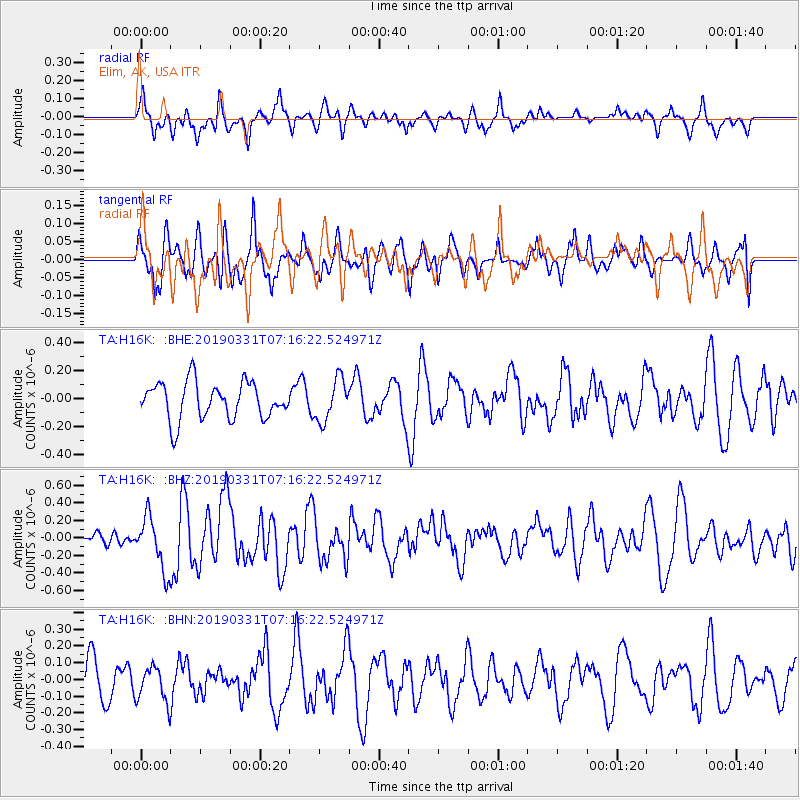
Signal To Noise
| Channel | StoN | STA | LTA |
| TA:H16K: :BHZ:20190331T07:16:22.524971Z | 2.3369696 | 3.0426477E-7 | 1.301963E-7 |
| TA:H16K: :BHN:20190331T07:16:22.524971Z | 0.8274084 | 1.04804286E-7 | 1.2666574E-7 |
| TA:H16K: :BHE:20190331T07:16:22.524971Z | 1.1350164 | 1.491428E-7 | 1.3140146E-7 |
| Arrivals |
| Ps | |
| PpPs | |
| PsPs/PpSs | |


