You are here: Home > Network List > TA - USArray Transportable Network (new EarthScope stations) Stations List
> Station J20K Nowitna River, AK, USA > Earthquake Result Viewer
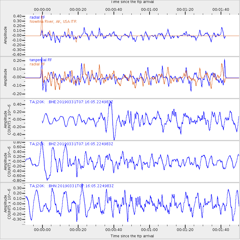
J20K Nowitna River, AK, USA - Earthquake Result Viewer
*The percent match for this event was below the threshold and hence no stack was calculated.
| Earthquake location: |
Near Coast Of Ecuador |
| Earthquake latitude/longitude: |
-2.0/-80.8 |
| Earthquake time(UTC): |
2019/03/31 (090) 07:04:04 GMT |
| Earthquake Depth: |
19 km |
| Earthquake Magnitude: |
6.2 Mww |
| Earthquake Catalog/Contributor: |
NEIC PDE/us |
|
| Network: |
TA USArray Transportable Network (new EarthScope stations) |
| Station: |
J20K Nowitna River, AK, USA |
| Lat/Lon: |
64.18 N/154.15 W |
| Elevation: |
314 m |
|
| Distance: |
84.6 deg |
| Az: |
335.072 deg |
| Baz: |
105.897 deg |
| Ray Param: |
$rayparam |
*The percent match for this event was below the threshold and hence was not used in the summary stack. |
|
| Radial Match: |
42.98267 % |
| Radial Bump: |
400 |
| Transverse Match: |
64.318886 % |
| Transverse Bump: |
400 |
| SOD ConfigId: |
13570011 |
| Insert Time: |
2019-05-02 20:33:31.824 +0000 |
| GWidth: |
2.5 |
| Max Bumps: |
400 |
| Tol: |
0.001 |
|
Signal To Noise
| Channel | StoN | STA | LTA |
| TA:J20K: :BHZ:20190331T07:16:05.224983Z | 4.0674877 | 5.766727E-7 | 1.4177613E-7 |
| TA:J20K: :BHN:20190331T07:16:05.224983Z | 0.82806385 | 8.500044E-8 | 1.0264962E-7 |
| TA:J20K: :BHE:20190331T07:16:05.224983Z | 1.1460402 | 1.00388604E-7 | 8.759605E-8 |
| Arrivals |
| Ps | |
| PpPs | |
| PsPs/PpSs | |


