
DGR Domenigoni Valley Reservior, California, USA - Earthquake Result Viewer
| ||||||||||||||||||
| ||||||||||||||||||
| ||||||||||||||||||
|
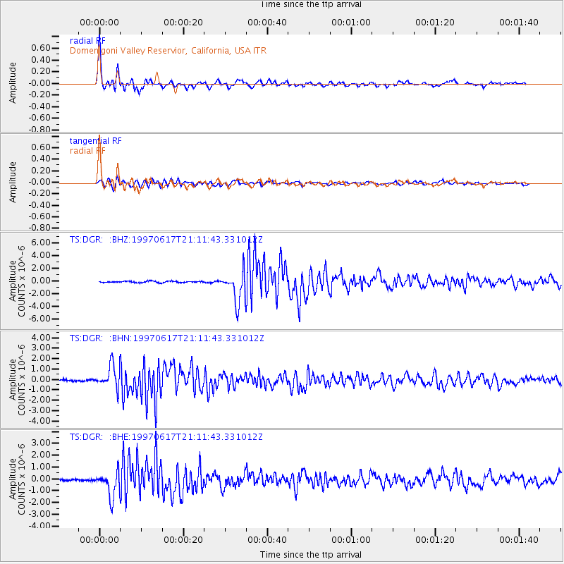
Signal To Noise
| Channel | StoN | STA | LTA |
| TS:DGR: :BHN:19970617T21:11:43.331012Z | 10.467864 | 1.1539485E-6 | 1.10237245E-7 |
| TS:DGR: :BHE:19970617T21:11:43.331012Z | 15.306271 | 1.1001702E-6 | 7.187709E-8 |
| TS:DGR: :BHZ:19970617T21:11:43.331012Z | 24.211744 | 2.537079E-6 | 1.0478712E-7 |
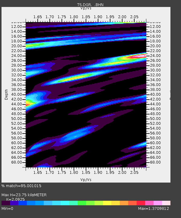
| Arrivals | |
| Ps | 4.3 SECOND |
| PpPs | 11 SECOND |
| PsPs/PpSs | 16 SECOND |

