You are here: Home > Network List > IU - Global Seismograph Network (GSN - IRIS/USGS) Stations List
> Station POHA Pohakuloa, Hawaii, USA > Earthquake Result Viewer
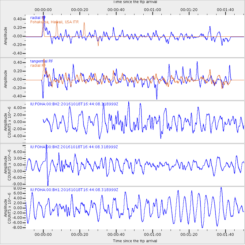
POHA Pohakuloa, Hawaii, USA - Earthquake Result Viewer
*The percent match for this event was below the threshold and hence no stack was calculated.
| Earthquake location: |
South Of Fiji Islands |
| Earthquake latitude/longitude: |
-23.3/-179.9 |
| Earthquake time(UTC): |
2016/10/18 (292) 16:36:41 GMT |
| Earthquake Depth: |
540 km |
| Earthquake Magnitude: |
5.9 MWW, 6.0 MWB |
| Earthquake Catalog/Contributor: |
NEIC PDE/NEIC COMCAT |
|
| Network: |
IU Global Seismograph Network (GSN - IRIS/USGS) |
| Station: |
POHA Pohakuloa, Hawaii, USA |
| Lat/Lon: |
19.76 N/155.53 W |
| Elevation: |
1990 m |
|
| Distance: |
49.0 deg |
| Az: |
31.024 deg |
| Baz: |
210.201 deg |
| Ray Param: |
$rayparam |
*The percent match for this event was below the threshold and hence was not used in the summary stack. |
|
| Radial Match: |
58.452736 % |
| Radial Bump: |
400 |
| Transverse Match: |
65.29033 % |
| Transverse Bump: |
357 |
| SOD ConfigId: |
1815711 |
| Insert Time: |
2016-11-01 16:38:37.263 +0000 |
| GWidth: |
2.5 |
| Max Bumps: |
400 |
| Tol: |
0.001 |
|
Signal To Noise
| Channel | StoN | STA | LTA |
| IU:POHA:00:BHZ:20161018T16:44:08.318999Z | 2.4149642 | 4.330892E-6 | 1.7933564E-6 |
| IU:POHA:00:BH1:20161018T16:44:08.318999Z | 0.72956735 | 2.4113924E-6 | 3.305236E-6 |
| IU:POHA:00:BH2:20161018T16:44:08.318999Z | 1.5684595 | 2.8664424E-6 | 1.8275528E-6 |
| Arrivals |
| Ps | |
| PpPs | |
| PsPs/PpSs | |


